Severe Thunderstorm Warning for Northeastern Mobile and Southeastern Washington Counties Until 6:45 PM CDT
The National Weather Service in Mobile has issued a Severe Thunderstorm Warning for northeastern Mobile County and southeastern Washington County in southwestern Alabama, effective until 6:45 PM CDT.
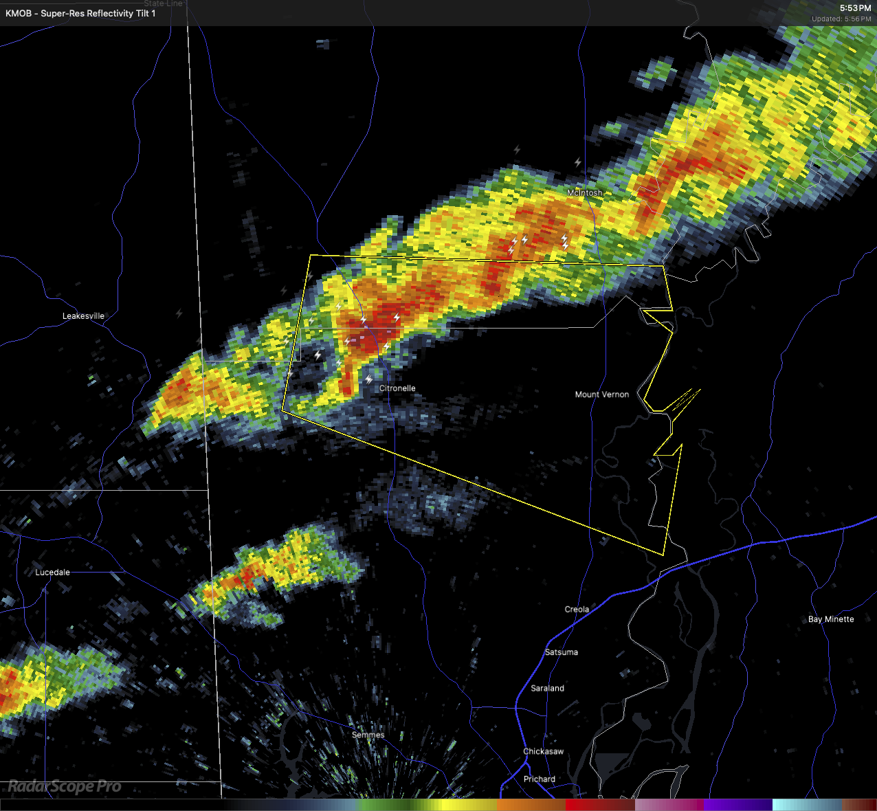
At 5:53 PM CDT, radar indicated a severe thunderstorm near Citronelle, moving east at 30 mph. This storm is producing quarter-size hail.
Impact:
Hail may cause damage to vehicles.
Locations in the path include:
Movico, Citronelle, Mount Vernon, and Calvert.
Safety Information:
Seek shelter inside a sturdy building. Move to an interior room on the lowest floor and avoid windows. Stay alert to additional warnings.
Category: Alabama's Weather, ALL POSTS, Severe Weather, Social Media
About the Author (Author Profile)
Scott Martin is an operational meteorologist, professional graphic artist, musician, husband, and father. Not only is Scott a member of the National Weather Association, but he is also the Central Alabama Chapter of the NWA president. Scott is also the co-founder of Racecast Weather, which provides forecasts for many racing series across the USA. He also supplies forecasts for the BassMaster Elite Series events including the BassMaster Classic.Subscribe
If you enjoyed this article, subscribe to receive more just like it.


