A Quick Radar Check at 6PM
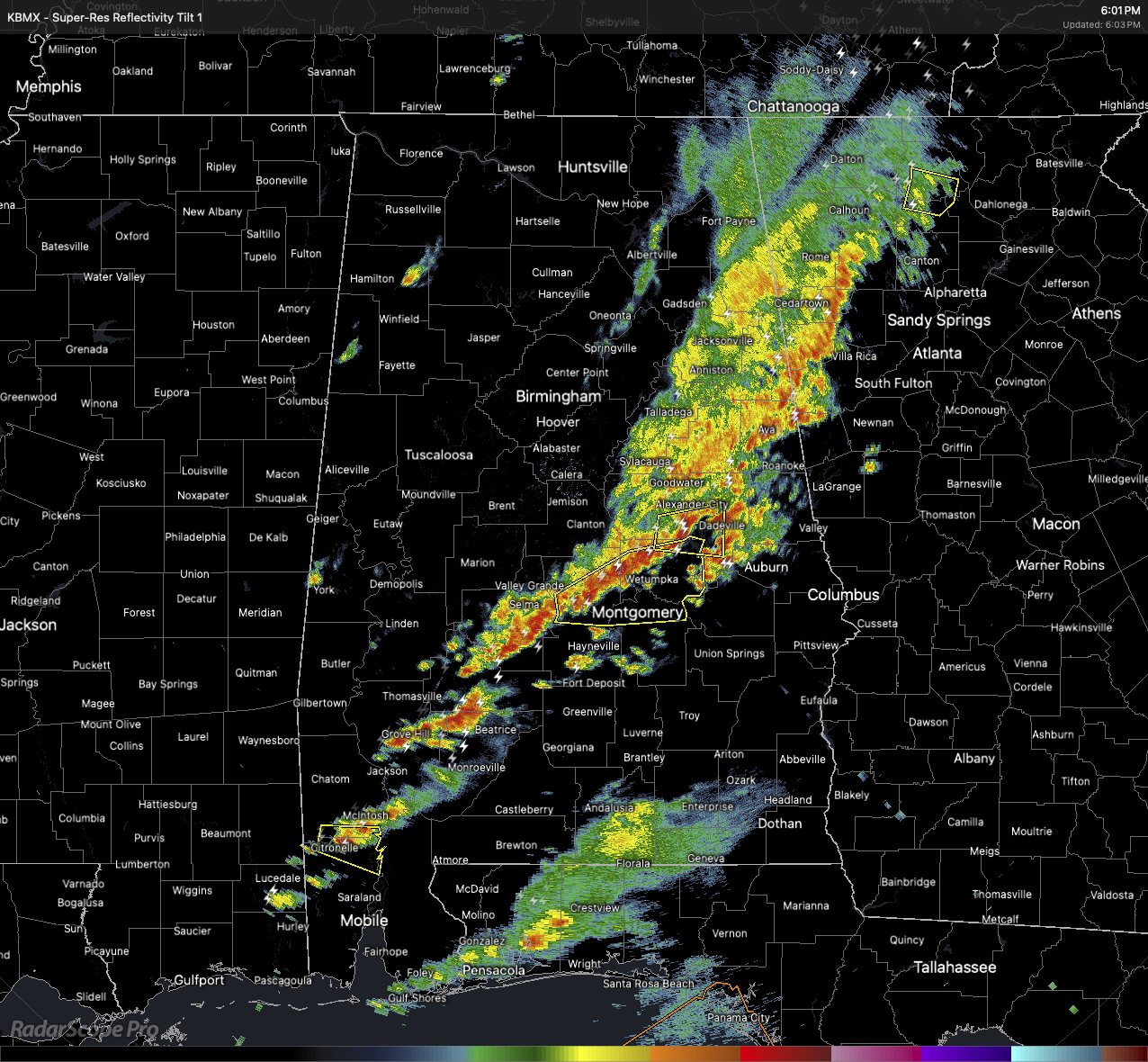
As of 6PM, the line of storms was currently affecting locations from Gadsden and Anniston, to Montgomery, Greenville, and down into Mobile and extending offshore to just south of Pensacola, Florida. The severe threat continues ahead of this line, but the threat has ended behind the line as the air is becoming much more stable.
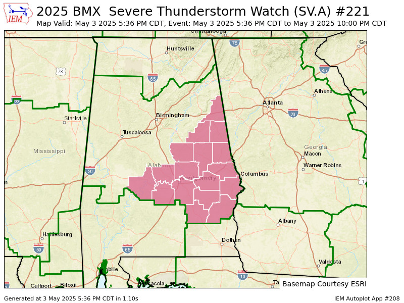
A Severe Thunderstorm Watch was recently issued for the southeastern parts of Central Alabama, which includes Autauga, Barbour, Bullock, Chambers, Clay, Cleburne, Coosa, Dallas, Elmore, Lee, Lowndes, Macon, Montgomery, Pike, Randolph, Russell, and Tallapoosa counties until 10PM tonight. As the line passes through those counties, NWS Birmingham will most likely remove those locations early behind the storms.
The threat will mainly be damaging wind gusts up to 60 MPH and large hail, but there is a very small tornado threat, as we have seen earlier up in northeast Alabama, where a possible tornado was spotted very near to Scottsboro.
Category: Alabama's Weather, ALL POSTS, Severe Weather, Social Media
About the Author (Author Profile)
Scott Martin is an operational meteorologist, professional graphic artist, musician, husband, and father. Not only is Scott a member of the National Weather Association, but he is also the Central Alabama Chapter of the NWA president. Scott is also the co-founder of Racecast Weather, which provides forecasts for many racing series across the USA. He also supplies forecasts for the BassMaster Elite Series events including the BassMaster Classic.Subscribe
If you enjoyed this article, subscribe to receive more just like it.


