Severe Thunderstorm Warning for Parts of Tallapoosa and Chambers Counties
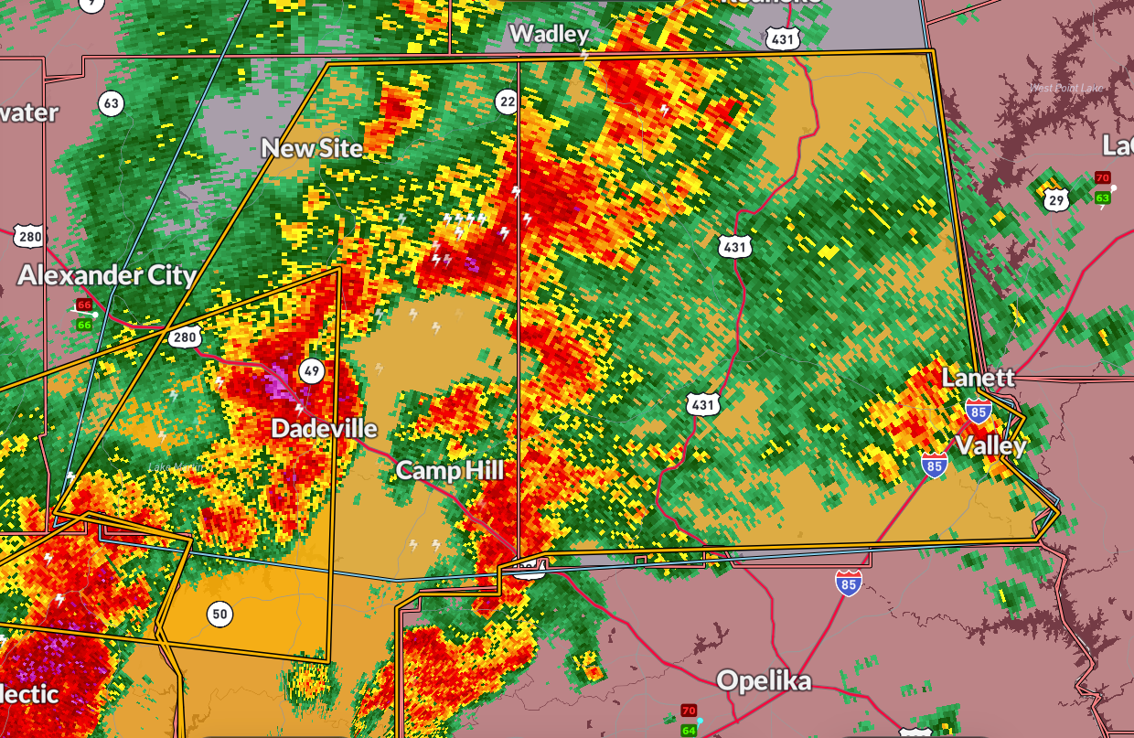
A severe thunderstorm warning is in effect until 7:45 PM for Tallapoosa and Chambers counties in east central Alabama. At 6:26 PM, radar showed strong storms stretching from near Southern Lake Martin to Abanda, moving east at 25 mph. These storms are capable of producing quarter-size hail and wind gusts up to 60 mph.
Locations in the path include Jacksons’ Gap, Horseshoe Bend, Lakeview, Lanett, Valley, Fairfax, and Reeltown. Torrential rain and frequent cloud-to-ground lightning are also occurring with these storms, and localized flooding is possible.
This line of storms is part of a broader severe weather complex that already prompted warnings in Montgomery, Elmore, Autauga, and Lowndes counties, where storms remain active as of 6:45 PM. Residents in the warned area should seek sturdy shelter and avoid driving through flooded roadways.
Category: Alabama's Weather, ALL POSTS, Severe Weather, Social Media
About the Author (Author Profile)
Bill Murray is the President of The Weather Factory. He is the site's official weather historian and a weekend forecaster. He also anchors the site's severe weather coverage. Bill Murray is the proud holder of National Weather Association Digital Seal #0001 @wxhistorianSubscribe
If you enjoyed this article, subscribe to receive more just like it.


