Alabama Weather Update at 7 p.m.
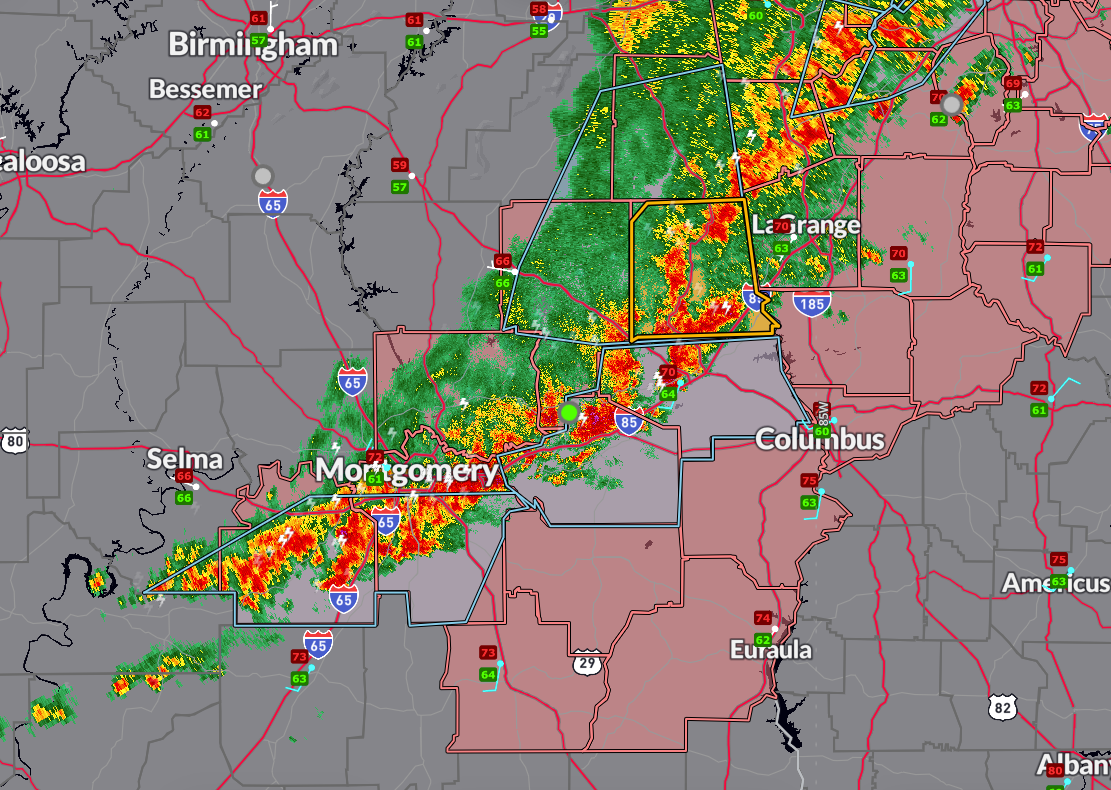
A severe thunderstorm warning remains in effect for Chambers County until 7:45 PM CDT. The warning for southeastern Tallapoosa County was cancelled at 6:54 PM as the strongest part of the storm moved east. The storm continues to produce wind gusts up to 60 mph and hail up to one inch in diameter as it tracks toward the Alabama–Georgia state line.
At 6:52 PM, a tree was reported down in Alexander City at North Central and Dejarnett Road. Road crews have been dispatched to clear the blockage.
A special weather statement was issued earlier for Randolph, Tallapoosa, Chambers, and southeastern Clay counties, noting strong thunderstorms capable of wind gusts up to 40 mph and small hail continuing through 7:15 PM. Another special weather statement remains in effect for Lowndes, southeastern Dallas, and Montgomery counties, also through 8:00 PM. Additionally, strong thunderstorms are impacting Lee and Macon counties with similar hazards through 7:45 PM.
Severe Thunderstorm Watch #221 has been cancelled for Autauga, Dallas, Coosa, Clay, and Cleburne counties. It remains in effect until 10 PM for Chambers, Lee, Bullock, Russell, Tallapoosa, Lowndes, Macon, Elmore, Montgomery, Pike, Barbour, and Randolph counties.
Residents in east and southeast Alabama should continue to monitor warnings and be prepared to take shelter as storms move through. Frequent lightning, torrential rain, and localized flooding remain possible.
Category: Alabama's Weather, ALL POSTS, Severe Weather, Social Media
About the Author (Author Profile)
Bill Murray is the President of The Weather Factory. He is the site's official weather historian and a weekend forecaster. He also anchors the site's severe weather coverage. Bill Murray is the proud holder of National Weather Association Digital Seal #0001 @wxhistorianSubscribe
If you enjoyed this article, subscribe to receive more just like it.


