Severe Storm Moves Into Lee County With Wind and Hail Threat
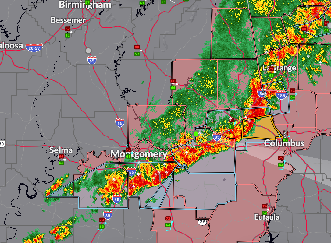
A new severe thunderstorm warning has been issued for northeastern Lee County until 8:00 PM CDT. At 7:14 PM, radar indicated a storm near Beauregard, moving east at 35 mph, producing wind gusts up to 60 mph and quarter-size hail. Areas including Auburn, Opelika, Smiths Station, and the Robert G. Pitts Airport are in the path of this storm. Frequent lightning, heavy rain, and the potential for flash flooding accompany this storm.
In addition, a special weather statement is in effect through 8:30 PM for northwestern Pike, Bullock, and southeastern Montgomery counties, where strong thunderstorms may produce gusty winds and small hail.
Earlier special weather statements remain in effect for Randolph, Tallapoosa, Chambers, southeastern Clay, Lowndes, Montgomery, Dallas, Lee, and Macon counties, where strong storms have been producing wind gusts between 40 and 50 mph, small hail, and heavy rainfall.
Severe Thunderstorm Watch #221 continues until 10 PM for Chambers, Lee, Bullock, Russell, Tallapoosa, Lowndes, Macon, Elmore, Montgomery, Pike, Barbour, and Randolph counties. Several counties to the northwest have been cleared from the watch.
Residents in eastern Alabama should remain weather-aware this evening as storms continue to move toward the Georgia state line. Stay indoors when thunder roars, and be prepared to seek shelter quickly if warnings are issued.
Category: Alabama's Weather, ALL POSTS, Severe Weather, Social Media
About the Author (Author Profile)
Bill Murray is the President of The Weather Factory. He is the site's official weather historian and a weekend forecaster. He also anchors the site's severe weather coverage. Bill Murray is the proud holder of National Weather Association Digital Seal #0001 @wxhistorianSubscribe
If you enjoyed this article, subscribe to receive more just like it.


