Strong Storms Persist in East Alabama With Gusty Winds and Small Hail
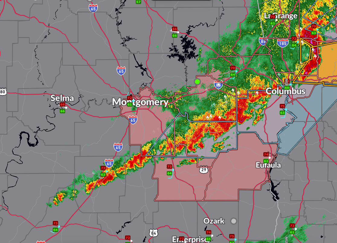
As of 8:10 PM CDT, there are no active severe thunderstorm warnings in Alabama, but several strong storms continue across the far eastern part of the state under significant weather advisories. The severe thunderstorm watch remains in effect until 10 PM for Lee, Bullock, Russell, Macon, Montgomery, Pike, and Barbour counties, but the risk appears to be gradually diminishing.
Special weather statements are currently in effect for Russell County through 8:45 PM and for parts of Pike, Bullock, and southeastern Montgomery counties through 8:30 PM. These storms are capable of wind gusts up to 50 mph, half-inch hail, torrential downpours, and frequent lightning—especially in and around Auburn, Opelika, Smiths Station, Tuskegee, and Union Springs. Earlier storms prompted damage reports, including downed trees in Tallapoosa County and hail near Marbury and across Elmore County.
According to the Storm Prediction Center, the best remaining chances for gusty winds and isolated strong cells are now focused on far eastern Alabama and into western Georgia. As temperatures cool and the atmosphere stabilizes, the overall severe threat will continue to wane. However, storms may linger for the next 1–2 hours with locally strong winds and lightning remaining possible.
Category: Alabama's Weather, ALL POSTS, Severe Weather, Social Media
About the Author (Author Profile)
Bill Murray is the President of The Weather Factory. He is the site's official weather historian and a weekend forecaster. He also anchors the site's severe weather coverage. Bill Murray is the proud holder of National Weather Association Digital Seal #0001 @wxhistorianSubscribe
If you enjoyed this article, subscribe to receive more just like it.


