Midday Nowcast: Dry Today, A Southern Soaker Ahead
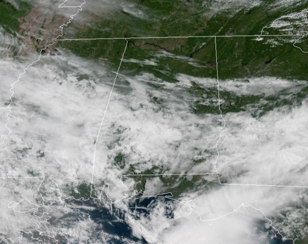
THE LAST DRY FOR AWHILE: It is another great day of weather with despite increasing clouds, it remains very comfortable with highs in the mid to upper 70s. This afternoon, some showers are likely to start sneaking into southwestern portions of the state with more widespread rain expected overnight.
BIRMINGHAM ALMANAC: For May 6th, the average high for Birmingham is 80° and the average low is 58°. The record high is 92° set in 1952, while the record low is 38° set in 1968. We average 0.16” of precipitation on this date and the record value is 3.85” set in 1967.
RAIN ON THE WAY: Umbrella alert as occasional rain and a few storms are in the forecast starting tonight, and they will continue the rest of this week and into the weekend. An upper-level low to our west will slowly move east and will bring widespread rain and storms to Alabama tonight and continuing the rest of this week. Though a few strong storms are possible, the air will be relatively stable, and severe storms are not expected. It won’t rain all the time, but periods of rain are likely Thursday and Friday. Highs will remain in the 70s due to the clouds and rain.
THE ALABAMA WEEKEND: The upper low will still be a player in our weather, and we will keep occasional rain in the forecast both days as the low moves ever so slightly eastward. Highs will remain in the mid to upper 70s. Rain amounts will be in the 1-3 inch range for most of Alabama through Sunday, but heavier amounts are possible mainly over the southern part of the state, where some spots could see 3-5 inches.
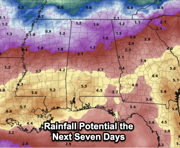
NEXT WEEK: The week looks to start off with continued showers in the forecast at least for Monday and Tuesday. Then the weather will trend drier and warmer over the latter half of next week as an upper ridge builds; some spots could touch 90 degrees by the end of the week.
WORLD TEMPERATURE EXTREMES: Over the last 24 hours, the highest observation outside the U.S. was 115.5F at Fujairah, United Arab Emirates. The lowest observation was -94.5F at Dome C, Antarctica.
CONTIGUOUS TEMPERATURE EXTREMES: Over the last 24 hours, the highest observation was 103F at Rio Grande Village, TX. The lowest observation was 18F at Red Lodge, MT.
Category: Alabama's Weather, ALL POSTS, Severe Weather
About the Author (Author Profile)
Macon, Georgia Television Chief Meteorologist, Birmingham native, and long time Contributor on AlabamaWX. Stormchaser. I did not choose Weather, it chose Me. College Football Fanatic. @Ryan_StinnetSubscribe
If you enjoyed this article, subscribe to receive more just like it.


