Rain Spreads Into Alabama Tonight; Wet Pattern Ahead
RADAR CHECK: We have a few patches of light rain over the central counties of Alabama this afternoon… otherwise the sky is partly sunny with temperatures mostly in the 70s. Communities across far South Alabama have reached the low 80s.
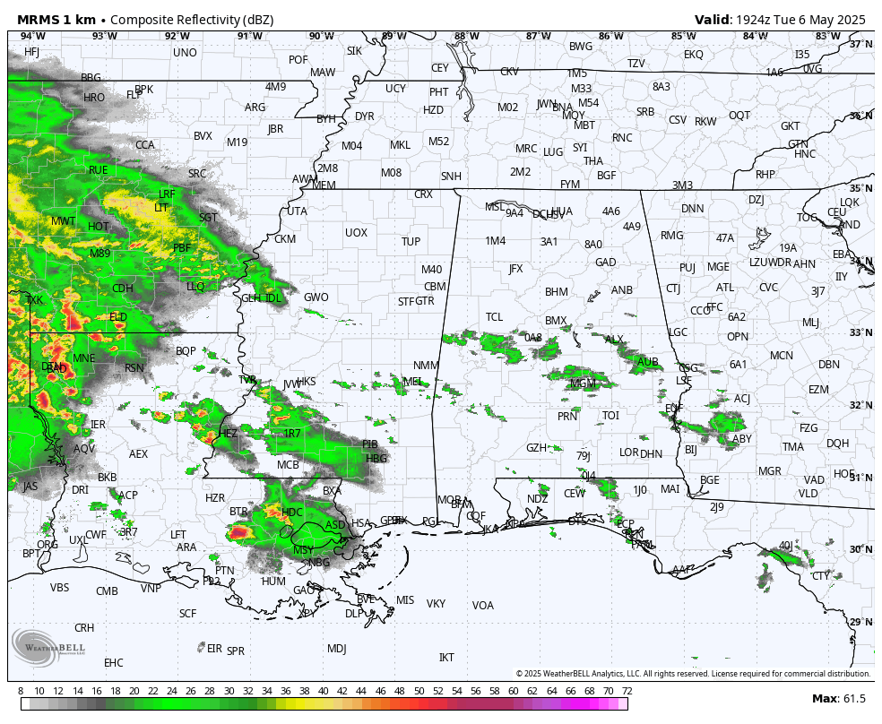
Tonight a large rain mass will likely move into the state ahead of a slow moving upper low to the west, which will keep Alabama’s weather wet at times for several days.
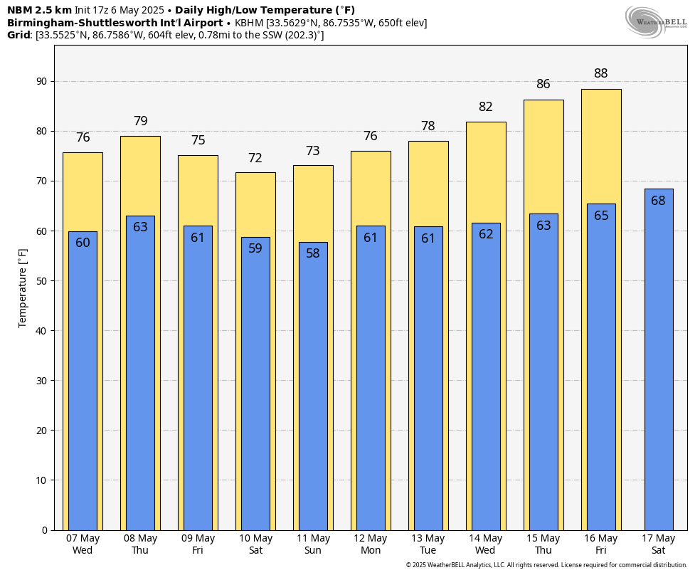
High resolution models actually show only widely scattered showers across Alabama during the day tomorrow, but then we will forecast periods of rain Thursday and Friday. Some thunder is possible, but severe storms are not expected with a stable airmass in place. Highs will be in the 70s through the week.
THE ALABAMA WEEKEND: Global models continue to show continued rain chances for the Deep South Saturday and Sunday thanks to a much slower motion of the upper low to the west. We will mention rain at times both days with highs remaining in the 70s. In fact, models now suggest the wet weather could continue all the way through Tuesday of next week.
Rain amounts over the next seven days will be in the 4-5 inch range for the southern half of Alabama, with potential of 1-3 inches for the northern counties.
The weather will trend drier and warmer over the latter half of next week as an upper ridge builds; some spots could touch 90 degrees by the end of the week. See the video briefing for maps, graphics, and more details.
ON THIS DATE IN 1967: An F3 tornado tore through the western part of the city of Birmingham that Saturday evening, just west of downtown… some of the heaviest damage was along Lomb Avenue, near Rickwood Field and the GES store (the Walmart of the day). One person was killed, and 25 people were injured along four mile path. Two homes were destroyed and sixty damaged. Another thirty industrial buildings were damaged.
ON THIS DATE IN 1975: A massive tornado hit Omaha, Nebraska killing three persons, injuring 133 others, and causing over 250 million dollars damage. The tornado struck during the late afternoon moving northeastward through the industrial and residential areas of west-central Omaha and lifting over the northern section of the city. The twister, which cut a swath ten miles long and as much as a quarter of a mile wide. It was the most costly in U.S. history up till that time.
Look for the next video briefing here by 6:00 a.m. tomorrow…
Category: Alabama's Weather, ALL POSTS, Weather Xtreme Videos
About the Author (Author Profile)
James Spann is one of the most recognized and trusted television meteorologists in the industry. He holds the AMS CCM designation and television seals from the AMS and NWA. He is a past winner of the Broadcast Meteorologist of the Year from both professional organizations.Subscribe
If you enjoyed this article, subscribe to receive more just like it.


