Tornado Warning: Radar-Detected Rotation Over Rural Areas of Southwest Alabama
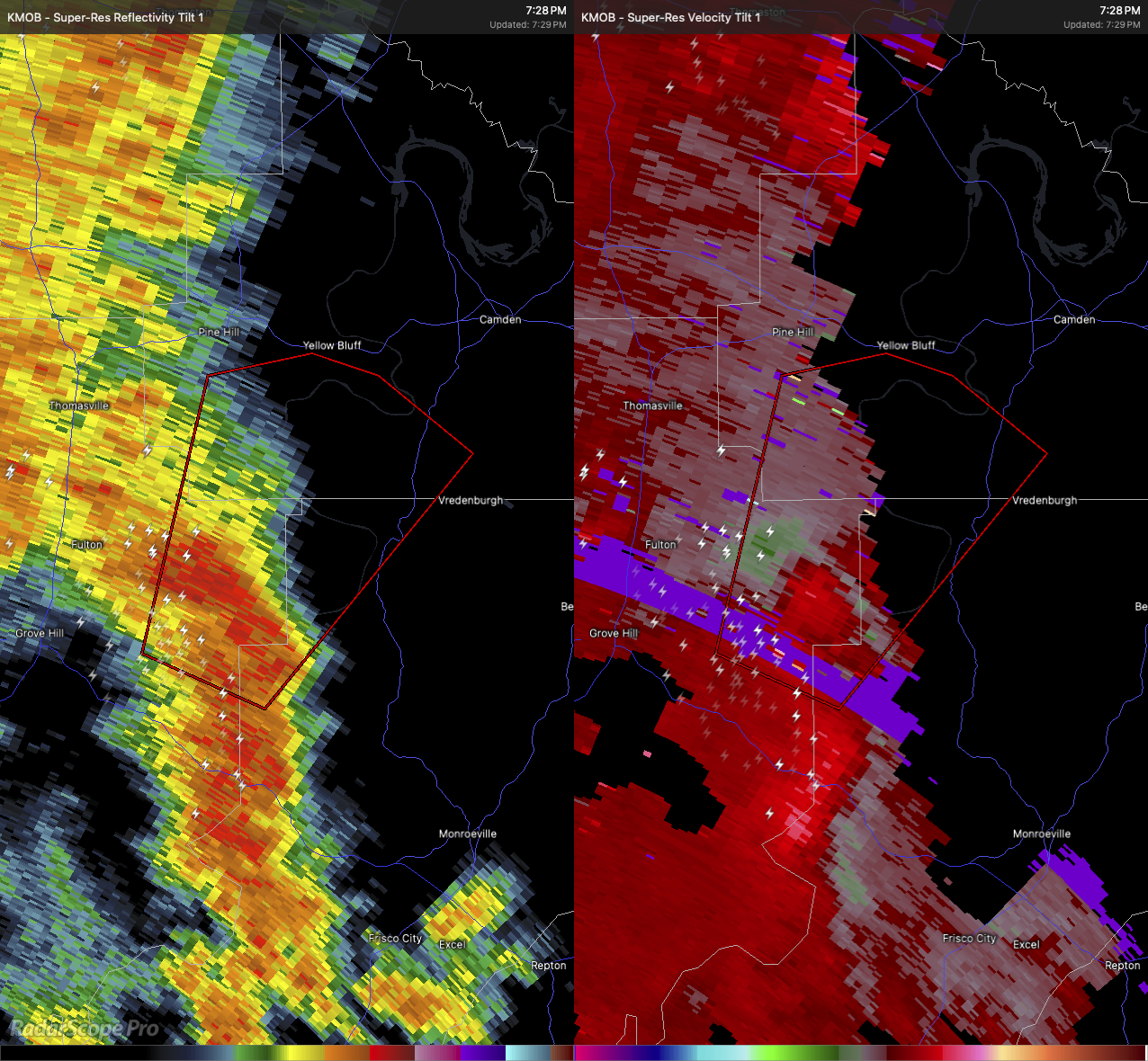
The National Weather Service in Mobile has issued a Tornado Warning for north central Monroe County, northeastern Clarke County, and southwestern Wilcox County, in southern and south-central Alabama, in effect until 8 PM CDT. At 7:19 PM, radar indicated a severe thunderstorm capable of producing a tornado located about 7 miles northeast of Whatley, or roughly 11 miles east of Grove Hill, moving north at 20 miles per hour.
This storm is showing rotation on radar and could quickly drop a tornado. If you’re in its path, flying debris could be life-threatening, especially if you’re caught without shelter. Mobile homes are particularly vulnerable, and damage to roofs, windows, vehicles, and trees is expected. This storm will remain mostly over rural portions of the warned counties.
If you’re anywhere near this storm, take cover immediately. Get to a basement or an interior room on the lowest floor of a sturdy structure. Stay away from windows, and if you’re outside or in a mobile home or vehicle, get to a stronger shelter right away.
Category: Alabama's Weather, ALL POSTS, Severe Weather
About the Author (Author Profile)
Scott Martin is an operational meteorologist, professional graphic artist, musician, husband, and father. Not only is Scott a member of the National Weather Association, but he is also the Central Alabama Chapter of the NWA president. Scott is also the co-founder of Racecast Weather, which provides forecasts for many racing series across the USA. He also supplies forecasts for the BassMaster Elite Series events including the BassMaster Classic.Subscribe
If you enjoyed this article, subscribe to receive more just like it.


