Midday Nowcast: Warmer with Only Isolated Showers Possible Today
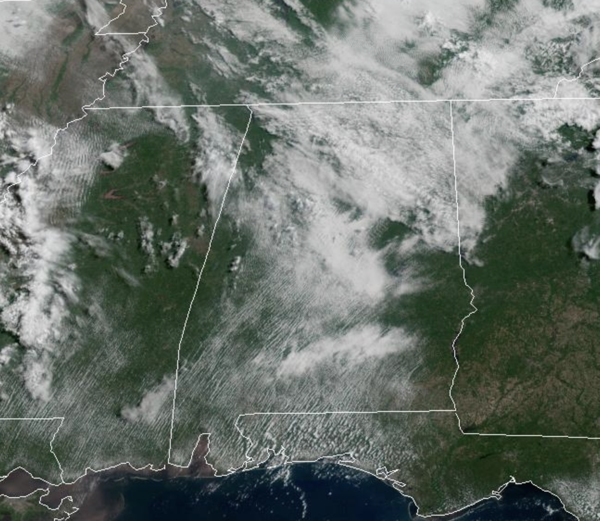
DRIER AND HOTTER: The upper low continues to pull away and the forecast today features more sun than clouds and most of the state will be dry, but a few isolated showers are possible over northeastern portions of the state. It is warmer today with highs in the mid to upper 80s. Tomorrow and Friday will be dry with a mix of sun and clouds both days. Afternoon highs will range from the upper 80s to lower 90s across all of Alabama. On Friday, severe weather is expected to the north of Alabama, in the Mid-South and Ohio Valley ahead of a cold front. Some of the showers and storms could drop into North Alabama Friday night as the cold front sinks south.
BIRMINGHAM ALMANAC: For May 14th, the average high for Birmingham is 82° and the average low is 61°. The record high is 93° set in 2018, while the record low is 41° set in 1971. We average 0.16” of precipitation on this date and the record value is 2.58” set in 1976.
USA BRIEF: Major to extreme Heat Risk will continue to impact much of southern Texas into next week, where widespread record-breaking highs and record warm overnight low temperatures are possible. Scattered strong to severe thunderstorms are possible mainly over parts of the Dakotas and Nebraska this afternoon and evening, and perhaps into far western Iowa and southwest Minnesota tonight.
WEEKEND WEATHER: The front slowly moves south but runs out of gas and stalls across northern portions of Alabama. Both Saturday and Sunday will feature rain and storms at times, mainly during the afternoon and evening hours. Just know, you may have to dodge some rain at times and to be safe keep the umbrella handy. We should see a more clouds than sun, with very warm and muggy conditions; highs generally in the mid 80s.
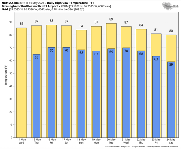
NEXT WEEK: We are forecasting a standard summer pattern next week with warm and muggy weather; highs in the 80s. For now, no big ticket weather system for Alabama, but each days will feature those random, garden variety, scattered afternoon showers and thunderstorms.
WORLD TEMPERATURE EXTREMES: Over the last 24 hours, the highest observation outside the U.S. was 116.8F at In Guezzam, Algeria. The lowest observation was -106.8F at Dome C, Antarctica.
CONTIGUOUS TEMPERATURE EXTREMES: Over the last 24 hours, the highest observation was 111F at Faith Ranch, TX. The lowest observation was 17F at Lund, NV.
Category: Alabama's Weather, ALL POSTS, Social Media
About the Author (Author Profile)
Macon, Georgia Television Chief Meteorologist, Birmingham native, and long time Contributor on AlabamaWX. Stormchaser. I did not choose Weather, it chose Me. College Football Fanatic. @Ryan_StinnetSubscribe
If you enjoyed this article, subscribe to receive more just like it.


