Severe Thunderstorm Warning for Lamar County Until 3:15 AM
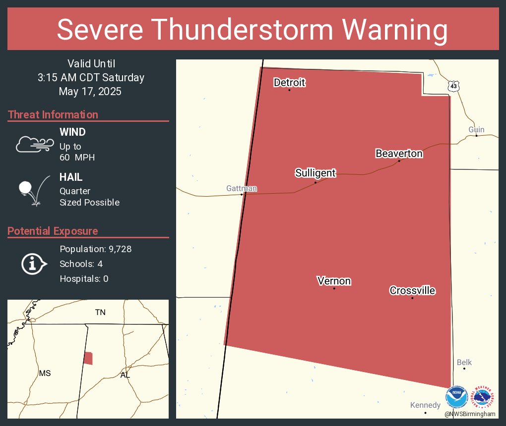

The National Weather Service in Birmingham has issued a Severe Thunderstorm Warning for all of Lamar County in west central Alabama, in effect until 3:15 AM CDT.
At 2:37 AM, a line of severe thunderstorms was moving east at 35 miles per hour, stretching from near Detroit to northwest of Sulligent and back toward Aberdeen. These storms are capable of producing wind gusts up to 60 miles per hour and hail up to the size of quarters.
Damaging winds could knock down trees and power lines, and the hail may cause damage to vehicles. Areas that could be impacted include Vernon, Sulligent, Detroit, Beaverton, and smaller communities like Cody, Blooming Grove, Pine Springs, and the Lamar County Public Lake area.
If you’re in the path of this storm, now is the time to get to a safe place—preferably an interior room on the lowest floor of a sturdy building. Stay weather aware as these storms continue to move across west Alabama early this morning.
Category: Alabama's Weather, ALL POSTS, Severe Weather
About the Author (Author Profile)
Scott Martin is an operational meteorologist, professional graphic artist, musician, husband, and father. Not only is Scott a member of the National Weather Association, but he is also the Central Alabama Chapter of the NWA president. Scott is also the co-founder of Racecast Weather, which provides forecasts for many racing series across the USA. He also supplies forecasts for the BassMaster Elite Series events including the BassMaster Classic.Subscribe
If you enjoyed this article, subscribe to receive more just like it.


