Severe Storm Potential Increasing for Tuesday Across Parts of the Tennessee Valley
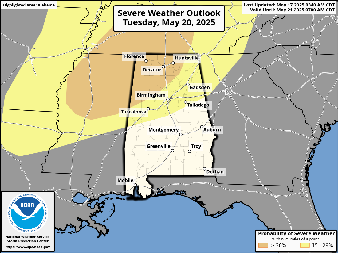
Looking ahead to Tuesday, conditions are shaping up for a round of potentially severe thunderstorms across portions of the Tennessee Valley, including parts of northern Alabama. As a strong upper-level trough shifts eastward, it’ll bring with it increased wind energy aloft and rising instability over our region.
Dewpoints will climb into the upper 60s to low 70s ahead of a cold front, and with plenty of heating expected, the atmosphere should become quite unstable, especially across north Alabama and areas just south of the Tennessee-Kentucky line. This kind of setup—warm, moist air at the surface with colder air aloft—can help storms grow rapidly and become severe.
With mid-level winds between 50 and 60 knots moving over the area, any storms that form during the afternoon will have plenty of shear to organize into supercells. These will mainly pose a threat for large hail, especially in areas where the atmosphere becomes moderately to strongly unstable. As we get into the evening hours, we may see these storms merge into a line or cluster, increasing the threat for damaging straight-line winds.
We’re still several days out, and details will become clearer with time, but folks across north and central Alabama should stay tuned for updates as we head into early next week.
Category: Alabama's Weather, ALL POSTS, Severe Weather, Social Media
About the Author (Author Profile)
Scott Martin is an operational meteorologist, professional graphic artist, musician, husband, and father. Not only is Scott a member of the National Weather Association, but he is also the Central Alabama Chapter of the NWA president. Scott is also the co-founder of Racecast Weather, which provides forecasts for many racing series across the USA. He also supplies forecasts for the BassMaster Elite Series events including the BassMaster Classic.Subscribe
If you enjoyed this article, subscribe to receive more just like it.


