Severe Thunderstorm Warning for Jefferson, Tuscaloosa, Walker, Pickens, Fayette, Lamar, Blount, Winston, and Greene Counties Until 5:00 AM
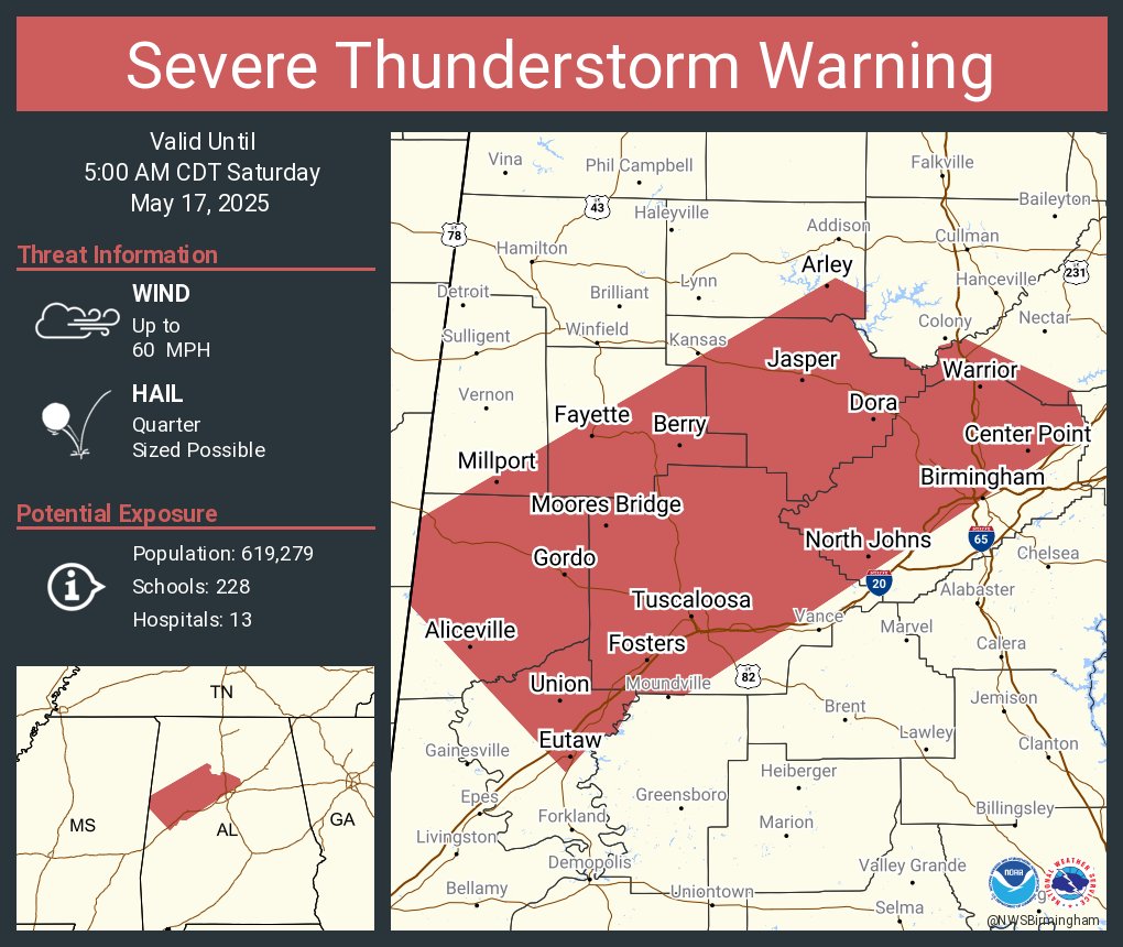
The National Weather Service in Birmingham has issued a Severe Thunderstorm Warning that remains in effect until 5:00 AM for several counties across central and west Alabama. This includes Jefferson, Tuscaloosa, Walker, Pickens, Fayette, southeastern Lamar, southwestern Blount, southeastern Winston, and northern Greene counties.
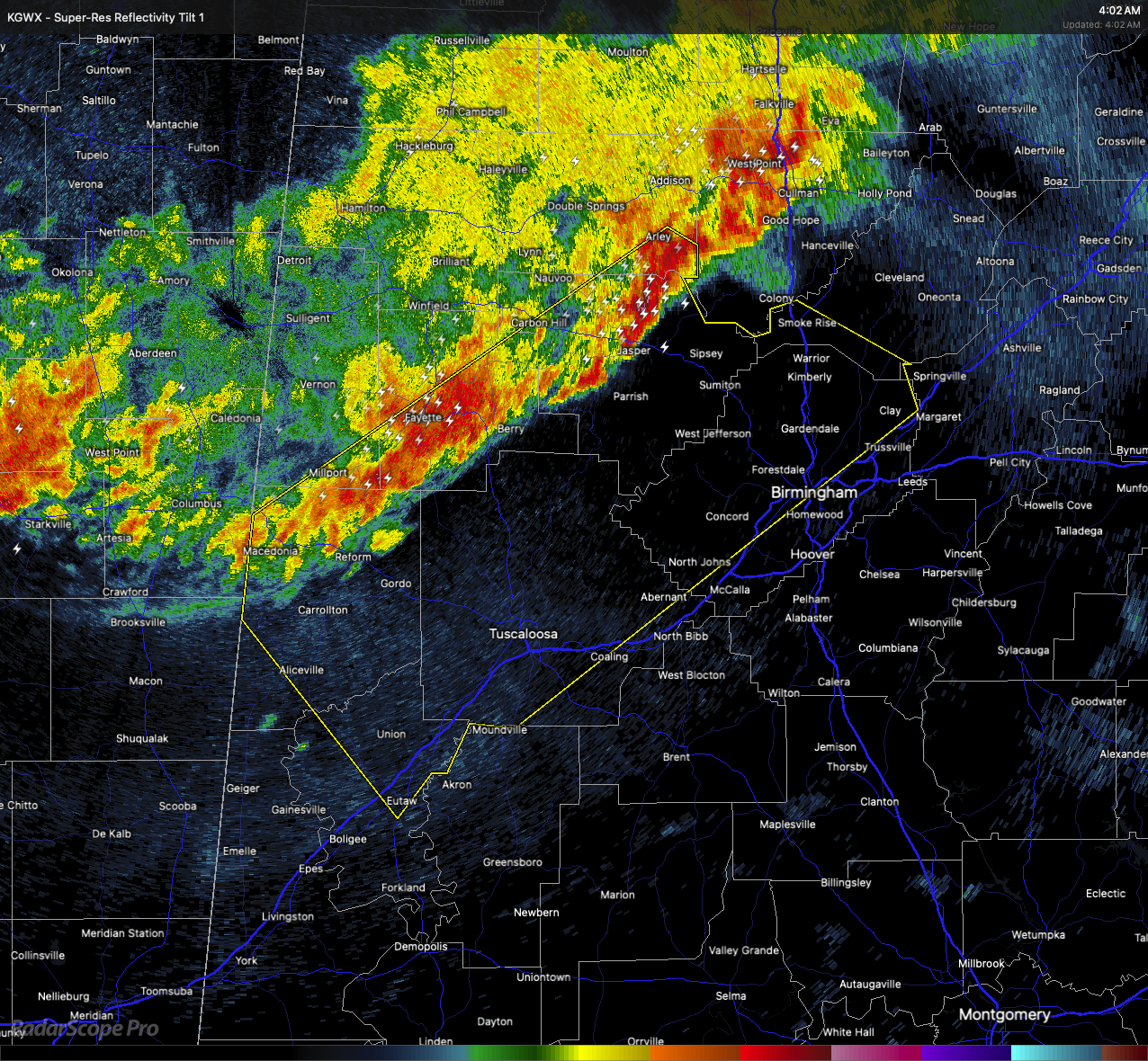
At 4:00 AM, a line of strong to severe thunderstorms was moving southeast at 35 miles per hour, stretching from near Smith Dam to Ethelsville. These storms are capable of producing wind gusts up to 60 miles per hour and hail up to the size of quarters.
Damage to roofs, siding, and trees is possible, along with hail damage to vehicles. Communities in the path include Aliceville, Fayette, Carrollton, Brookwood, Englewood, New Castle, Samantha, McFarland Mall, and Camp Horne, among others.
If you are in the warned area, now is the time to move to a safe place. Get to an interior room on the lowest floor of a sturdy building and stay away from windows. These storms have the potential to cause damage, so don’t take any chances.
Category: Alabama's Weather, ALL POSTS, Severe Weather, Social Media
About the Author (Author Profile)
Scott Martin is an operational meteorologist, professional graphic artist, musician, husband, and father. Not only is Scott a member of the National Weather Association, but he is also the Central Alabama Chapter of the NWA president. Scott is also the co-founder of Racecast Weather, which provides forecasts for many racing series across the USA. He also supplies forecasts for the BassMaster Elite Series events including the BassMaster Classic.Subscribe
If you enjoyed this article, subscribe to receive more just like it.


