Severe Thunderstorm Warning for Shelby, Southeastern Jefferson, and Central St. Clair Counties Until 5:45 AM
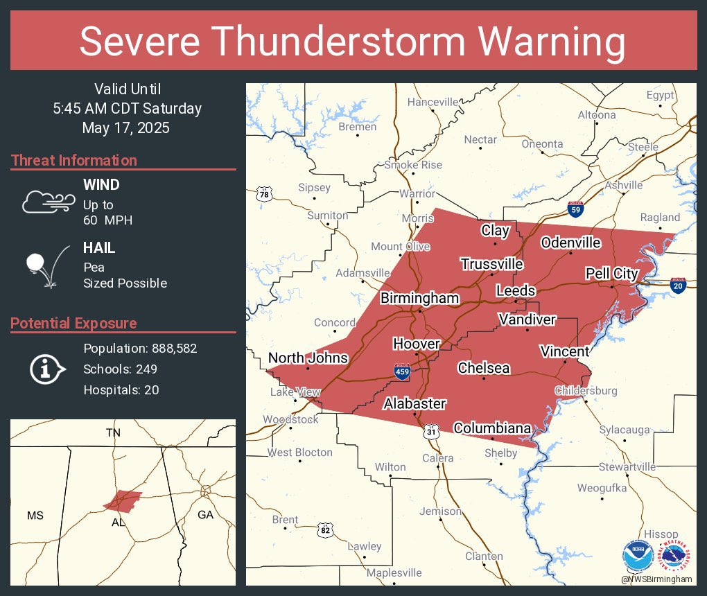
The National Weather Service in Birmingham has issued a Severe Thunderstorm Warning for Shelby County, southeastern Jefferson County, and central St. Clair County, effective until 5:45 AM.
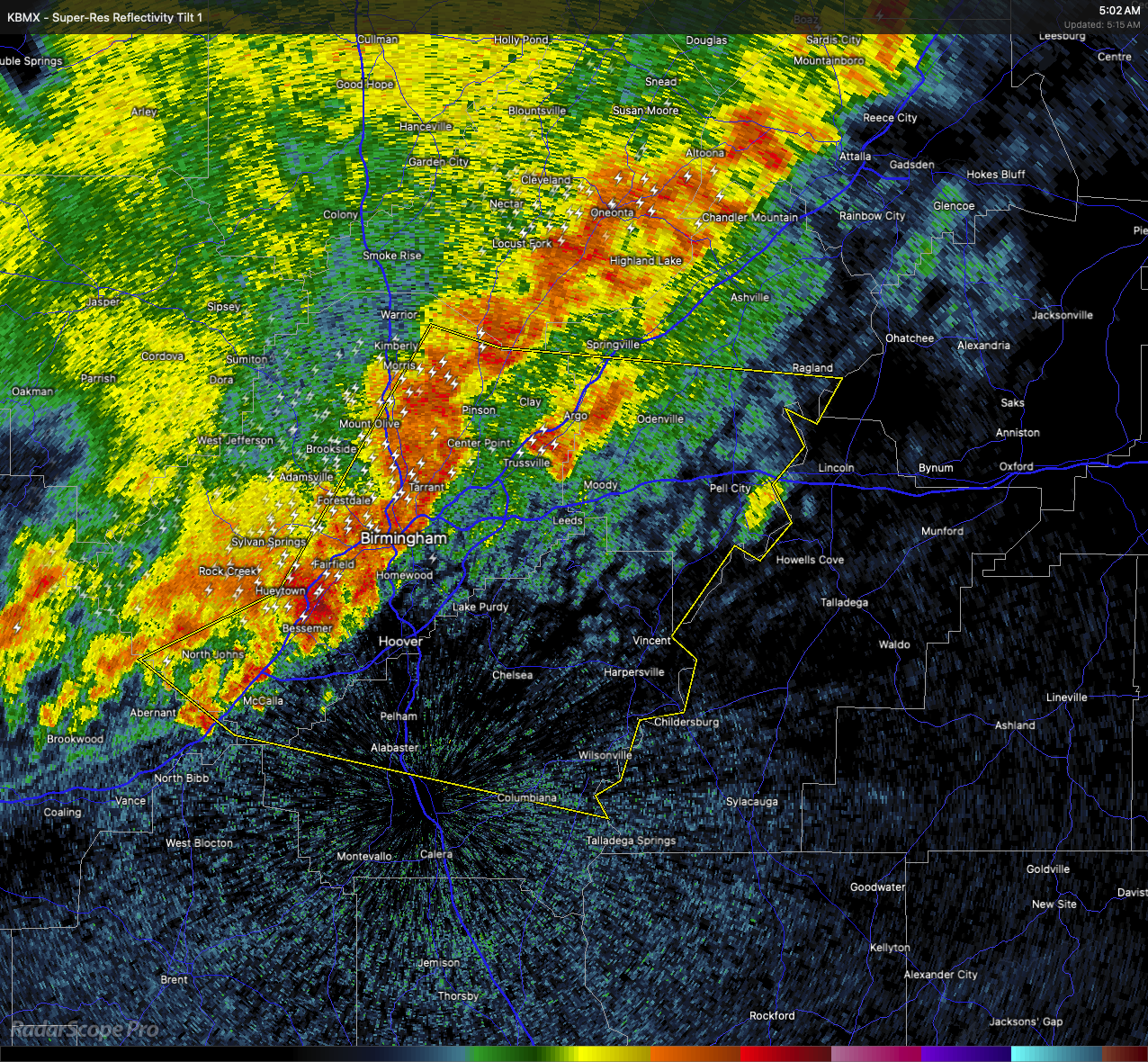
At 4:59 AM, radar showed a line of strong thunderstorms moving east at 50 miles per hour, stretching from near Morris to Brighton and toward Deerlick Creek Campgrounds. These storms are producing wind gusts up to 60 miles per hour.
Residents in Mountain Brook, Palmerdale, Wattsville, Westover, New Castle, Oak Mountain State Park, Helena, Leeds, Moody, and surrounding communities should prepare for damaging winds that could impact roofs, siding, and trees.
If you are in the warned area, take shelter immediately. Move to an interior room on the lowest floor of a sturdy building and stay away from windows until the threat passes.
Category: Alabama's Weather, ALL POSTS, Severe Weather
About the Author (Author Profile)
Scott Martin is an operational meteorologist, professional graphic artist, musician, husband, and father. Not only is Scott a member of the National Weather Association, but he is also the Central Alabama Chapter of the NWA president. Scott is also the co-founder of Racecast Weather, which provides forecasts for many racing series across the USA. He also supplies forecasts for the BassMaster Elite Series events including the BassMaster Classic.Subscribe
If you enjoyed this article, subscribe to receive more just like it.


