Weather Briefing: Potential for Strong Storms Through Early Week
Good early morning, Central Alabama! It’s 5 a.m., and here’s your latest weather outlook through the end of the week and into next weekend. No video for today as there is an ongoing severe weather threat.
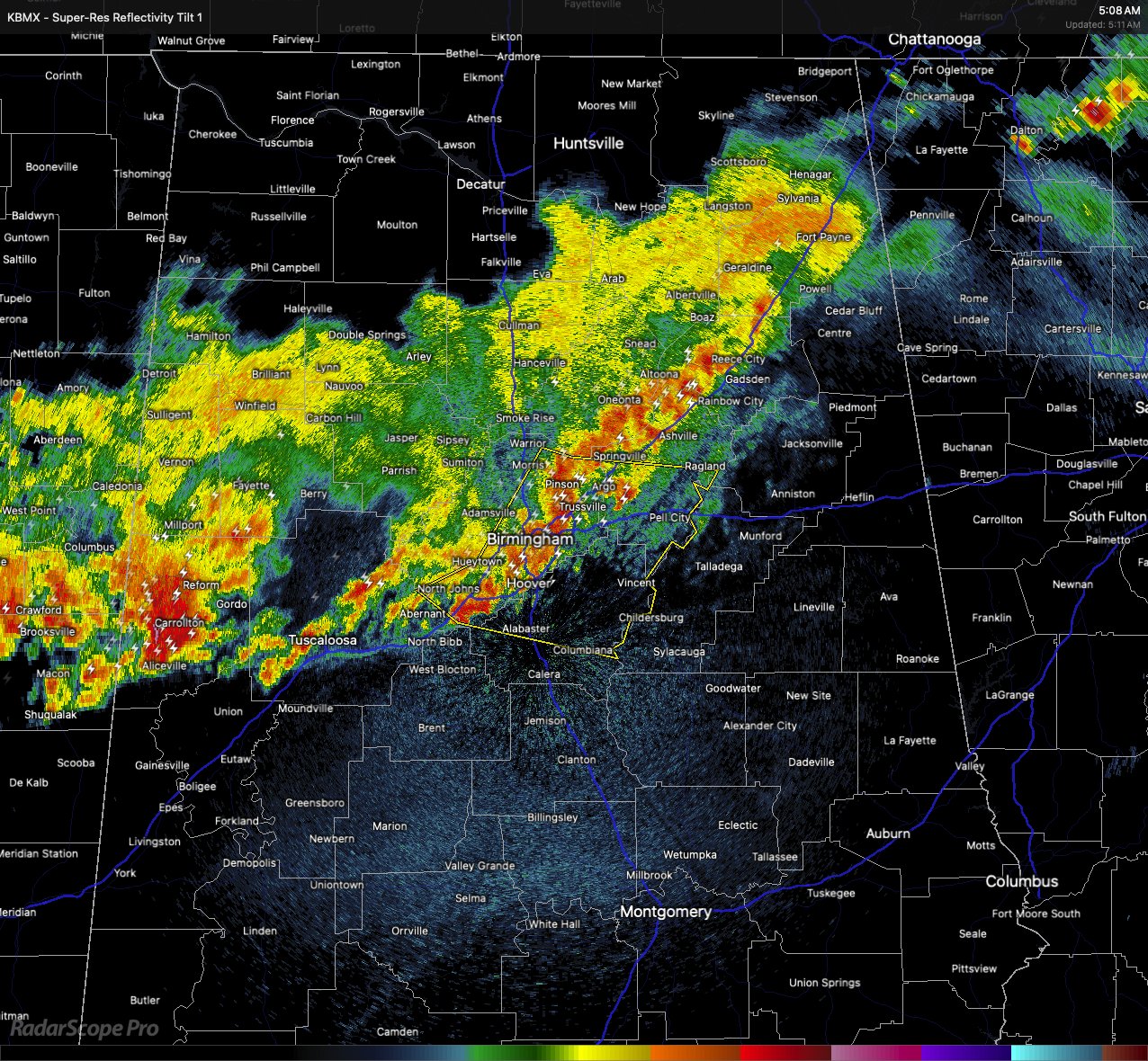
This Morning and Afternoon: Strong to severe thunderstorms pushed in overnight and into daybreak. Most of that activity is winding down this morning. We expect a ragged line of storms by mid-morning as the better forcing lifts north of us. The atmosphere remains unstable this afternoon, so a marginal risk for severe storms stays in place. If storms redevelop later today — depending on leftover boundaries from this morning’s storms — damaging winds and large hail will be possible.
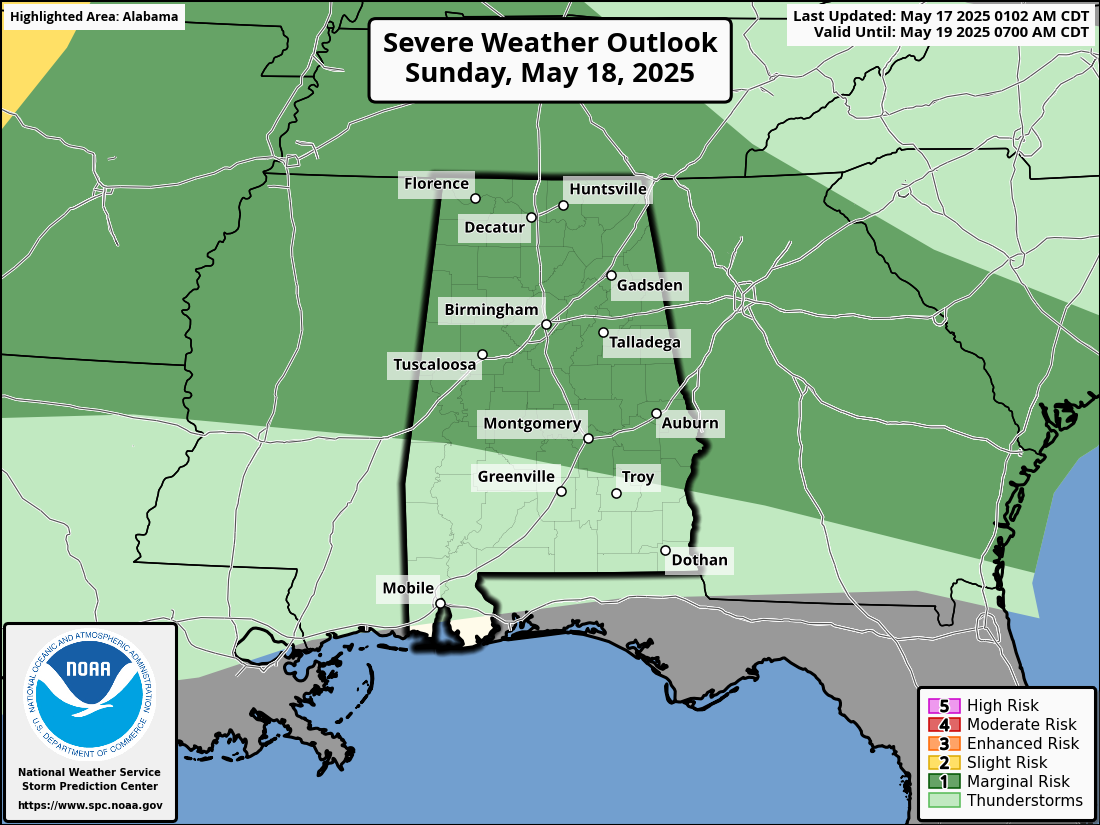
Sunday: Another marginal risk remains as a new round of storms pushes in. These could be a bit more organized, but it’s still uncertain. Damaging winds and hail are the main threats again. In North Alabama, lingering showers and elevated storms will lift northeastward, mainly impacting northeast Mississippi and northwest Alabama during the late morning and afternoon. Wind gusts up to 40-50 mph and small hail are possible. A second round of storms Sunday night could develop, but impacts look mainly northwest of our area. Highs Sunday will stay warm in the mid to upper 80s.
Monday and Tuesday: Monday looks mostly dry with highs in the mid to upper 80s. A ridge of high pressure builds overhead. Late Monday night into Tuesday morning, some scattered storms could pop near a warm front — mostly north of us.
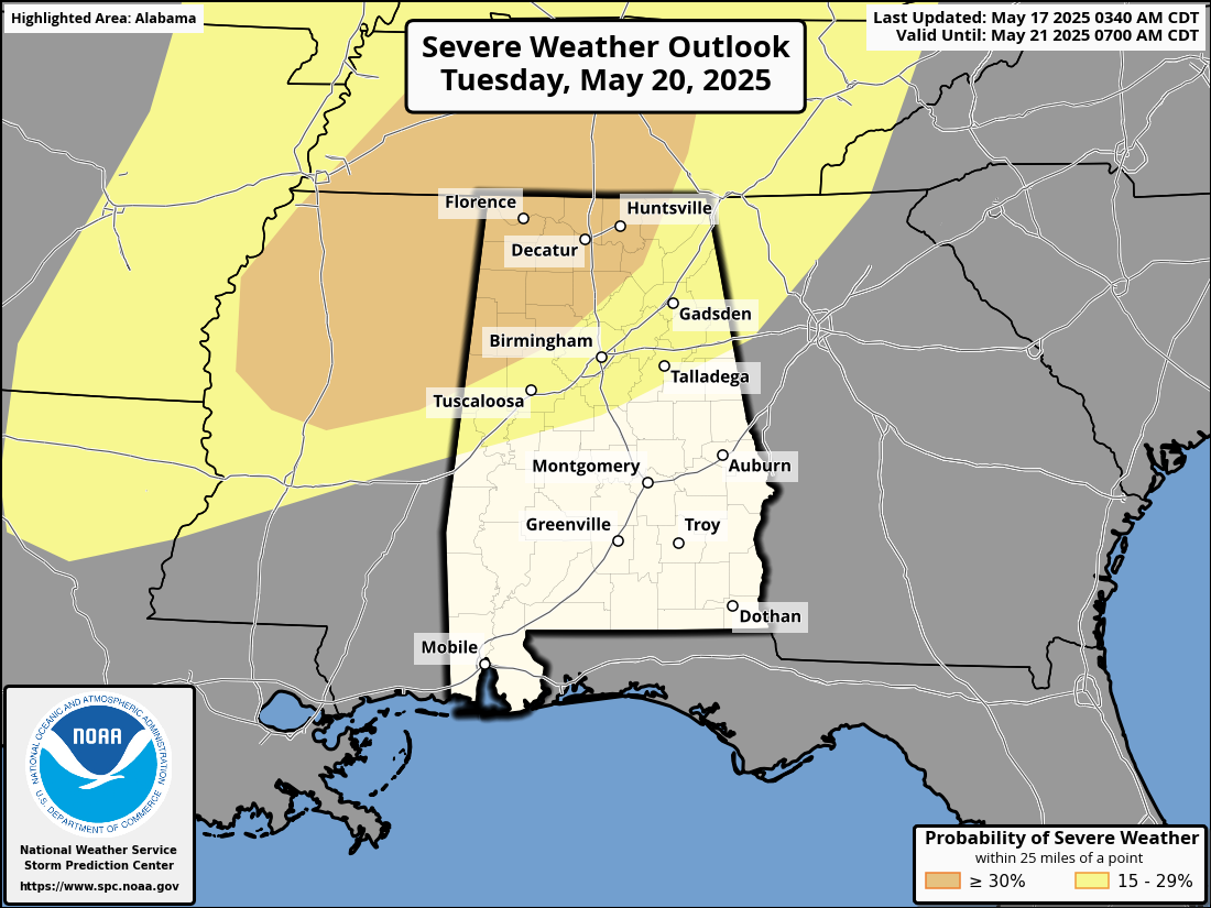
Tuesday Night Through Wednesday: Tuesday night brings a more organized trough and cold front pushing toward the region. While the strongest forcing stays north, Central Alabama can’t rule out a few strong to severe storms if the atmosphere remains unstable. Temperatures will cool behind the front Wednesday, with highs dropping into the upper 70s and low 80s.
Thursday: It will feel noticeably cooler and more comfortable, with highs mostly in the low to upper 70s across Central Alabama. Expect mostly dry conditions with a refreshing change in the air thanks to the cold front settling in.
Friday: It will look similar to Thursday — dry, pleasant, and cooler than what we’ve seen recently. Highs should stay in the 70s, making it a great day to enjoy the outdoors without the typical summer heat.
Make sure to stay weather aware through the weekend, especially if you live north of I-20 where stronger storms could linger into early Sunday. We’ll keep you updated with any changes.
Category: Alabama's Weather, ALL POSTS, Severe Weather, Social Media, Weather Xtreme Videos
About the Author (Author Profile)
Scott Martin is an operational meteorologist, professional graphic artist, musician, husband, and father. Not only is Scott a member of the National Weather Association, but he is also the Central Alabama Chapter of the NWA president. Scott is also the co-founder of Racecast Weather, which provides forecasts for many racing series across the USA. He also supplies forecasts for the BassMaster Elite Series events including the BassMaster Classic.Subscribe
If you enjoyed this article, subscribe to receive more just like it.


