Severe Thunderstorm Watch 275 Continues Across Central Alabama This Morning
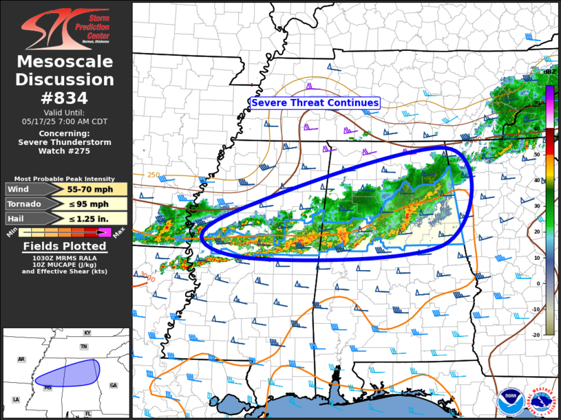
The severe weather threat remains ongoing this morning under Severe Thunderstorm Watch 275 for central Alabama. Long-lasting clusters of thunderstorms are moving eastward across northern Mississippi and central Alabama, with isolated hail and strong wind gusts still possible.
A particularly strong thunderstorm capable of producing hail and damaging winds continues pushing across central Alabama. Behind it, a line of storms extends into southeast Arkansas. Some of the stronger storm cores over central Alabama have tapped into a very unstable atmosphere, with CAPE values exceeding 2000 J/kg, combined with strong wind shear. This environment can support bursts of severe weather despite an overall expected weakening trend as we move into the cooler morning hours.
While the general trend will be for storms to lessen in strength, occasional pulses of severe hail or wind can’t be ruled out. Forecasters are also watching the possibility of extending the Severe Thunderstorm Watch further south across central Alabama if storm intensity increases again. Conversely, some areas may see the watch canceled early if conditions improve.
Keep an eye on the weather and be ready to take shelter if conditions worsen.
Category: Alabama's Weather, ALL POSTS, Severe Weather, Social Media
About the Author (Author Profile)
Scott Martin is an operational meteorologist, professional graphic artist, musician, husband, and father. Not only is Scott a member of the National Weather Association, but he is also the Central Alabama Chapter of the NWA president. Scott is also the co-founder of Racecast Weather, which provides forecasts for many racing series across the USA. He also supplies forecasts for the BassMaster Elite Series events including the BassMaster Classic.Subscribe
If you enjoyed this article, subscribe to receive more just like it.


