Severe Thunderstorm Warning for Northeastern Chilton and Southwestern Coosa Counties Until 7:15 AM
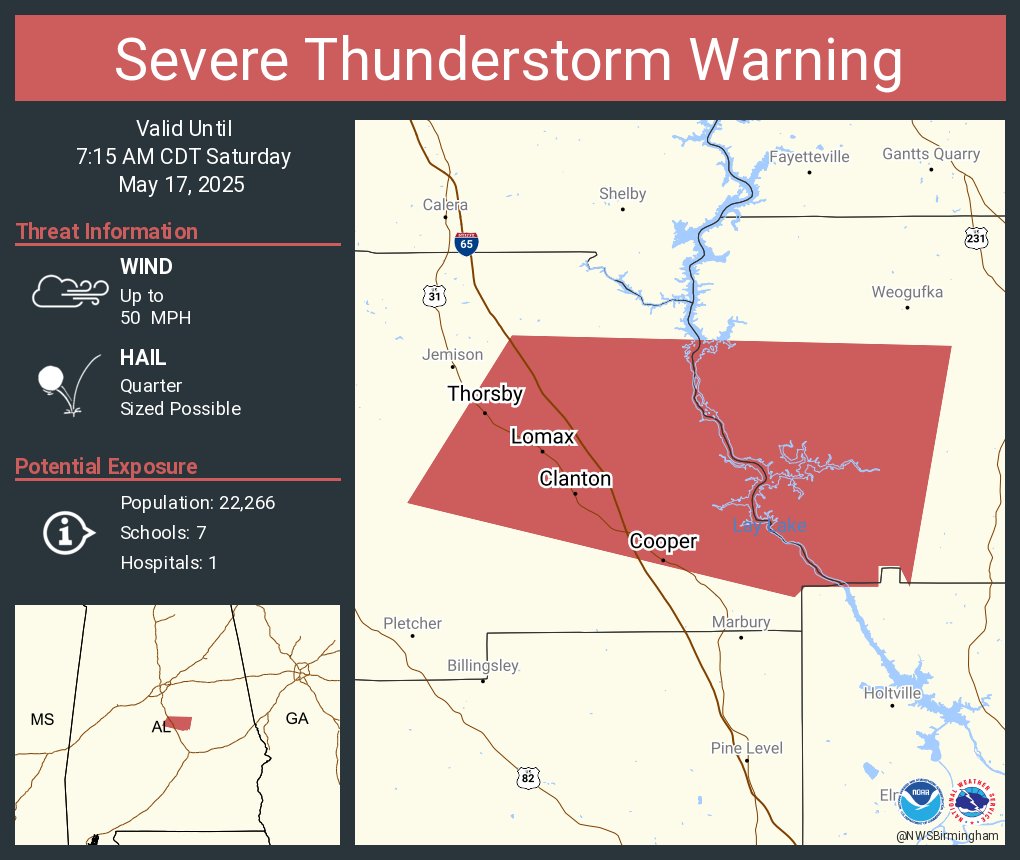
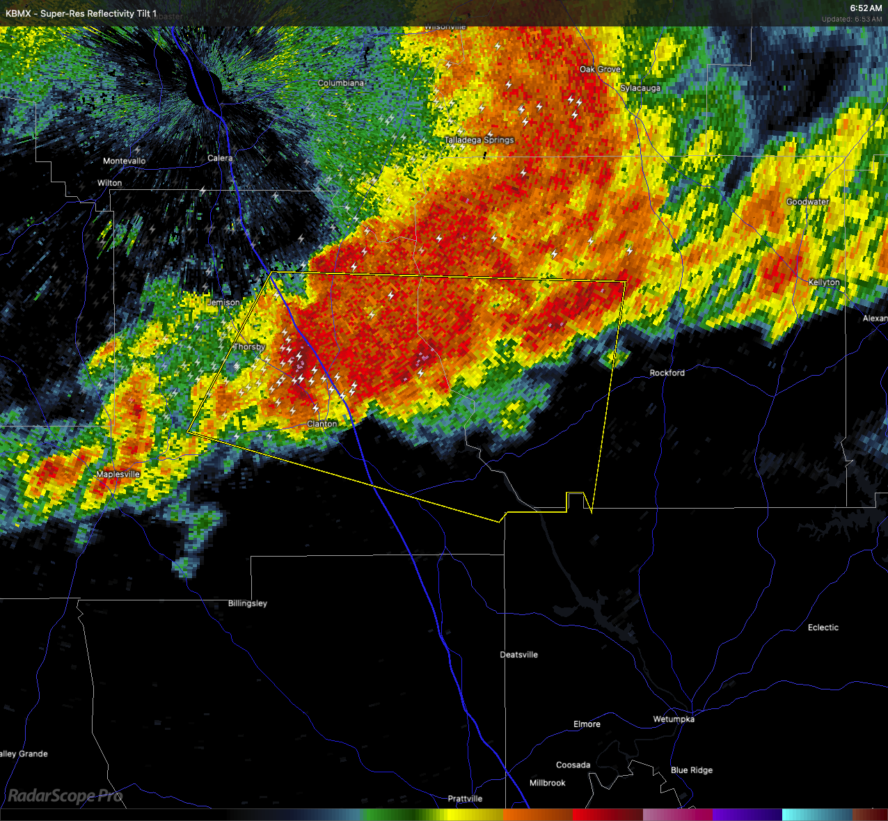
A severe thunderstorm warning is now in effect for northeastern Chilton County and southwestern Coosa County through 7:15 this morning. As of 6:51 AM, radar indicated a strong storm centered near the Gap of the Mountain area, right over Clanton, and it’s tracking east at about 45 miles per hour.
This storm is capable of producing quarter-size hail, which could damage vehicles and other exposed property. Folks in places like Thorsby, Lomax, Higgins Ferry Park, Mitchell Dam, Paint Creek, and Lay Lake should be ready to move to a safe place until the storm passes.
If you’re in the path of this storm, head to an interior room on the lowest floor of your home or building and stay away from windows.
Category: Alabama's Weather, ALL POSTS, Severe Weather, Social Media
About the Author (Author Profile)
Scott Martin is an operational meteorologist, professional graphic artist, musician, husband, and father. Not only is Scott a member of the National Weather Association, but he is also the Central Alabama Chapter of the NWA president. Scott is also the co-founder of Racecast Weather, which provides forecasts for many racing series across the USA. He also supplies forecasts for the BassMaster Elite Series events including the BassMaster Classic.Subscribe
If you enjoyed this article, subscribe to receive more just like it.


