Severe Storms Across Alabama on this Sunday Morning: Could Have 80 mph Winds!
For the second morning in a row, strong to severe storms are moving across Alabama, this time across the North Central part of the state.
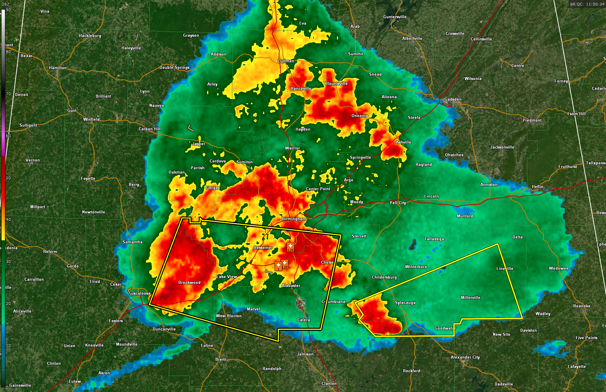
The mass of rain and storms covers parts of Morgan, Winston, Cullman, Blount, Walker, Jefferson, St. Clair, Tuscaloosa, Shelby, and Talladega counties and is moving into Etowah, Calhoun, Clay, and Randolph counties.
1.25 inch hail was reported near Hoover just after 6 am and 1 inch hail was reported near Lake Cyrus in Shelby County about the same time.
WEA alerts are sounding for the severe thunderstorm warning for Jefferson, Bibb, Shelby and Tuscaloosa Counties for 80 mph winds.
And this just in…a severe thunderstorm warning is in effect until 7:00 AM CDT for Clay County, northeastern Coosa County, and southwestern Talladega County. At 6:21 AM, radar indicated a strong storm near Stewartville moving east at 45 mph. Residents in areas like Ashland, Hollins, and Millerville should be alert for damaging winds and potentially large hail as this storm pushes through.
Category: Alabama's Weather, ALL POSTS, Severe Weather, Social Media
About the Author (Author Profile)
Bill Murray is the President of The Weather Factory. He is the site's official weather historian and a weekend forecaster. He also anchors the site's severe weather coverage. Bill Murray is the proud holder of National Weather Association Digital Seal #0001 @wxhistorianSubscribe
If you enjoyed this article, subscribe to receive more just like it.


