Severe Storms Continue Across the Region: Tornado, Large Hail, and Damaging Wind Threats Increasing
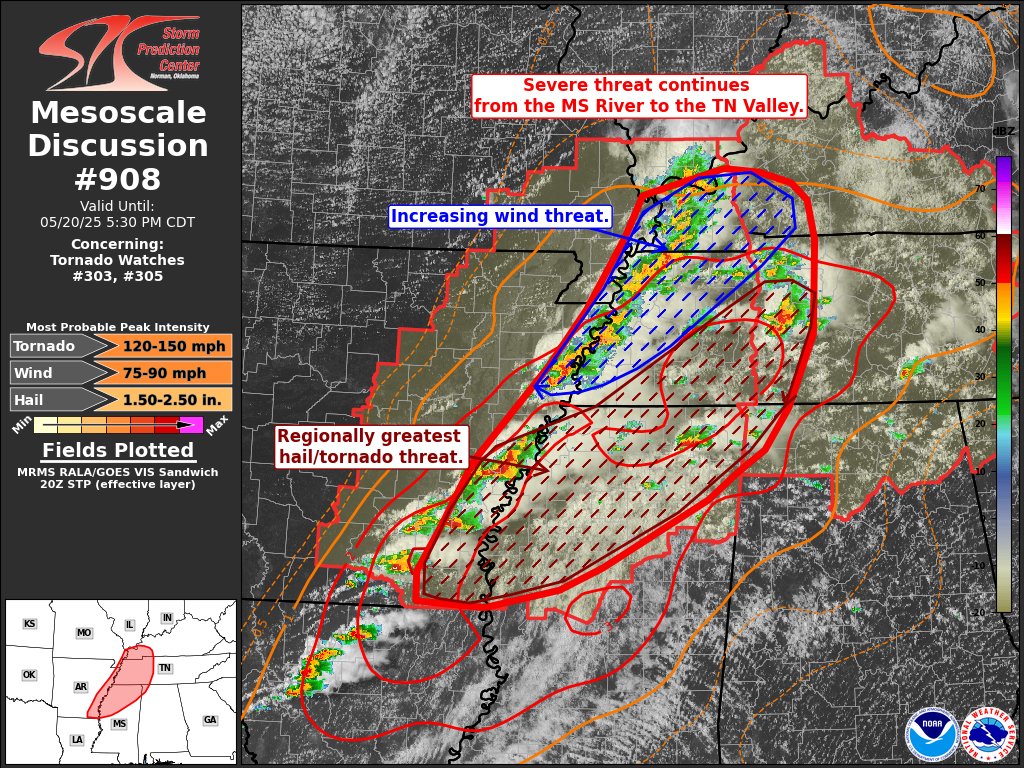
The severe weather situation remains active this morning across areas covered by Severe Thunderstorm Watches 303 and 305. While the risk for large hail and isolated tornadoes continues, we are now seeing signs that damaging winds may become a more widespread concern over the next couple of hours—especially for northwest Tennessee and parts of far southwest Kentucky.
Farther south and east, the strongest storms are now located across southeast Arkansas, northeast Mississippi, and into portions of middle Tennessee. This is where the environment remains especially favorable for intense supercell development. These storms have already produced large hail, with reports up to golf ball size, and conditions remain supportive of even larger hail—potentially up to 2.5 inches in diameter. In addition, strong wind shear and high instability are helping these storms to maintain organized rotation, increasing the risk for tornadoes, including the possibility of a strong one. Activity could also move into the northwest corner of Alabama.
If you’re in or near these areas, stay weather-aware and be ready to take quick action if warnings are issued. This is a dynamic and evolving situation, and additional watches or warnings are likely to be needed as these storms continue pushing eastward.
Category: Alabama's Weather, ALL POSTS, Severe Weather
About the Author (Author Profile)
Scott Martin is an operational meteorologist, professional graphic artist, musician, husband, and father. Not only is Scott a member of the National Weather Association, but he is also the Central Alabama Chapter of the NWA president. Scott is also the co-founder of Racecast Weather, which provides forecasts for many racing series across the USA. He also supplies forecasts for the BassMaster Elite Series events including the BassMaster Classic.Subscribe
If you enjoyed this article, subscribe to receive more just like it.


