Severe Thunderstorm Warning for Central Lauderdale and Northwestern Colbert Counties Until 5:00 PM
Heads up for folks in northwestern Alabama—severe storms are bearing down on central Lauderdale and northwestern Colbert counties, and they mean business. The National Weather Service in Huntsville has issued a Severe Thunderstorm Warning for this area, effective until 5:00 PM.
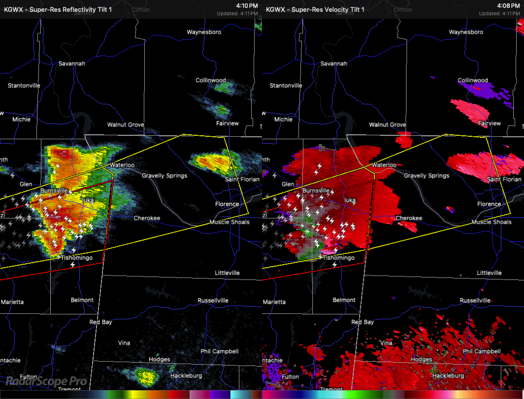
At 4:09 PM, radar was tracking a strong storm near Midway, just southwest of Iuka, and it’s moving east at about 40 miles per hour. This storm is packing a punch, with ping pong ball size hail and wind gusts up to 60 miles per hour. That kind of hail can cause serious damage to vehicles, roofs, and windows, and those winds are strong enough to take down trees and power lines.
Communities that could be impacted include Malone, Mt Hester, Cherokee, Florence, Allsboro, Riverton, Wright, Oakland, Barton, and Waterloo.
This is also a storm that could spin up a tornado quickly, so stay alert. If you’re in the path of this storm, now is the time to move to the lowest floor of a sturdy building—preferably in an interior room away from windows. Don’t wait to hear a siren; take shelter when warnings are issued.
A Tornado Watch remains in effect until 10:00 PM for much of north central and northwestern Alabama. Stay weather aware this evening, and be ready to act quickly if conditions worsen.
Category: Alabama's Weather, ALL POSTS, Severe Weather, Social Media
About the Author (Author Profile)
Scott Martin is an operational meteorologist, professional graphic artist, musician, husband, and father. Not only is Scott a member of the National Weather Association, but he is also the Central Alabama Chapter of the NWA president. Scott is also the co-founder of Racecast Weather, which provides forecasts for many racing series across the USA. He also supplies forecasts for the BassMaster Elite Series events including the BassMaster Classic.Subscribe
If you enjoyed this article, subscribe to receive more just like it.


