Tornado Warning for Southern Colbert and South Central Lauderdale Counties Until 5:15 PM
A dangerous situation is unfolding in northwestern Alabama. The National Weather Service in Huntsville has issued a Tornado Warning for southern Colbert County and south central Lauderdale County, in effect until 5:15 PM.
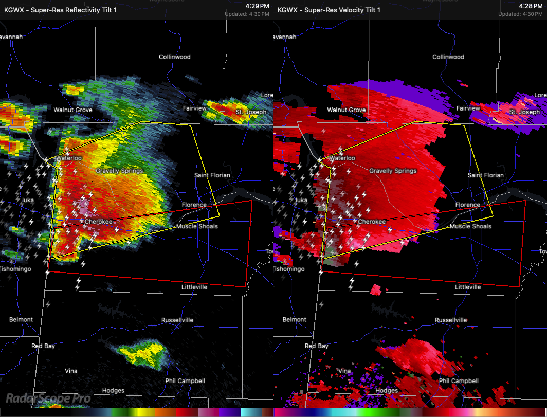
At 4:29 PM, a severe thunderstorm capable of producing a tornado was located 8 miles northeast of Tishomingo State Park, moving east at 40 mph. This storm is also producing golf ball size hail and has strong rotation visible on radar—an indicator of a developing or ongoing tornado.
Impacts:
Flying debris will be dangerous to anyone caught without shelter.
Mobile homes could be destroyed.
Expect damage to roofs, windows, and vehicles.
Tree damage is likely.
Communities in the path include:
Cherokee around 4:35 PM
Tuscumbia around 4:50 PM
Sheffield around 4:55 PM
Muscle Shoals around 5:00 PM
Other locations at risk: Malone, Posey Loop, Northwest Alabama Regional Airport, Mt Hester, New Bethel, Allsboro, Maud, Barton, Red Rock, and Mynot.
TAKE COVER NOW! If you’re in the warned area, move to a basement or small, interior room on the lowest floor of a sturdy building. Stay away from windows. If you’re in a mobile home or vehicle, get to a substantial shelter immediately and protect yourself from flying debris.
This is a potentially life-threatening situation—act now.
Category: Alabama's Weather, ALL POSTS, Severe Weather, Social Media
About the Author (Author Profile)
Scott Martin is an operational meteorologist, professional graphic artist, musician, husband, and father. Not only is Scott a member of the National Weather Association, but he is also the Central Alabama Chapter of the NWA president. Scott is also the co-founder of Racecast Weather, which provides forecasts for many racing series across the USA. He also supplies forecasts for the BassMaster Elite Series events including the BassMaster Classic.Subscribe
If you enjoyed this article, subscribe to receive more just like it.


