Severe Storms Likely Over North Alabama This Evening/Tonight; Drier Tomorrow
ACTIVE NIGHT AHAED: We have just a few isolated showers over Northwest Alabama at mid-afternoon. Earlier today there was one small supercell storm that clipped the northwest corner of the state near Waterloo, producing a tornado.
Tonight we have a significant risk of severe storms over the northern half of the state as a dynamic weather system approaches.
SPC has defined an “enhanced risk” (level 3/5) of severe thunderstorms as far south as Tuscaloosa, Calera, and Wedowee. There is a “slight risk” (level 2/5) as far south as Demopolis, Marbury, and Lafayette. And, a “marginal risk” (level 1/5) down to Grove Hill, Highland Home, and Phenix City.
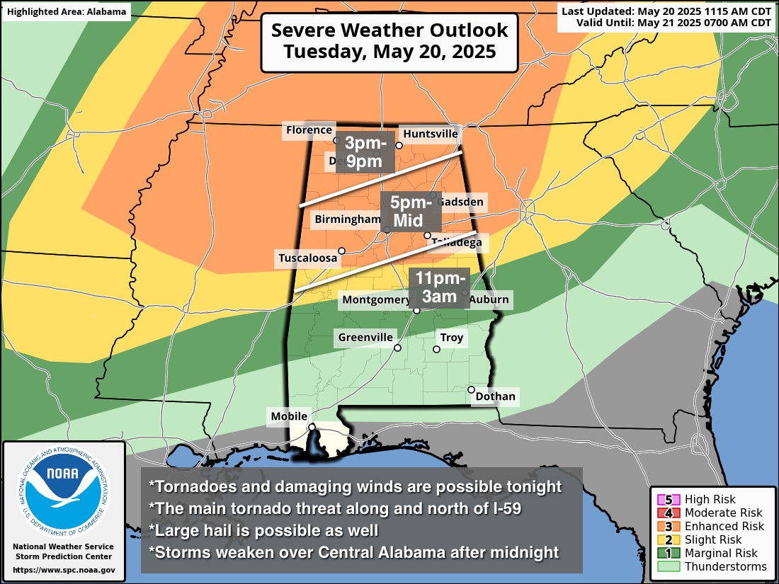
Here are the key messages for this event…
*All modes of severe weather are possible over North Alabama with this event. The highest risk of tornadoes is in the “enhanced risk” in any discrete cells that form ahead of the main line. A strong tornado (EF-2 or higher) can’t be ruled out.
*As the storms evolve into a line, a couple of brief, isolated tornadoes are still possible.
*As the storms become linear, the main threat will shift to damaging straight line winds. Possibly 70 mph in spots.
*Large hail is also possible with the heavier thunderstorms.
*Storms should slowly weaken late tonight as they move south of I-20; there is no risk of severe storms over the southern third of the state.
*Events like this are common in Alabama in May, which is part of our tornado season (which runs from November through May). No need to be worried or anxious, just have a reliable way of hearing warnings (never an outdoor siren!), have a good plan, and we will get through it together.
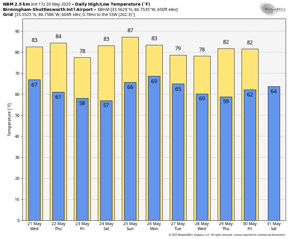
REST OF THE WEEK: A few lingering showers are possible tomorrow morning over South Alabama, but the weather will be mostly dry tomorrow through Friday. Highs will be the low to mid 80s tomorrow and Thursday; a cooler airmass arrives Friday as highs drop into the 70s over the northern half of the state. Most North Alabama communities will drop into the 50s early Friday morning.
MEMORIAL DAY WEEKEND: While South Alabama will be dry Saturday and Sunday, we will mention a chance of scattered showers both days over the northern half of the state. Not a wash-out, and not raining everywhere. Then, on Monday, showers and storms become likely statewide ahead of a cold front. For now it doesn’t look like a severe thunderstorm setup.
Cooler, drier air rolls into the Deep South Tuesday; the weather looks quiet for the rest of the week. See the video briefing for maps, graphics, and more details.
ON THIS DATE IN 1957: A tornado touched down to the southwest of Kansas City and traveled a distance of seventy-one miles cutting a swath of near destruction through the southeastern suburbs of Ruskin Heights and Hickman Mills. The tornado claimed the lives of forty-five persons and left hundreds homeless.
Look for the next video update here by 6:00 a.m. tomorrow…
Category: Alabama's Weather, ALL POSTS, Weather Xtreme Videos
About the Author (Author Profile)
James Spann is one of the most recognized and trusted television meteorologists in the industry. He holds the AMS CCM designation and television seals from the AMS and NWA. He is a past winner of the Broadcast Meteorologist of the Year from both professional organizations.Subscribe
If you enjoyed this article, subscribe to receive more just like it.


