Severe Thunderstorm Warning for Northwestern Madison and East Central Limestone Counties Until 7:30 PM CDT
The National Weather Service in Huntsville has issued a Severe Thunderstorm Warning for northwestern Madison County and east central Limestone County in north central Alabama. This warning is in effect until 7:30 PM CDT.
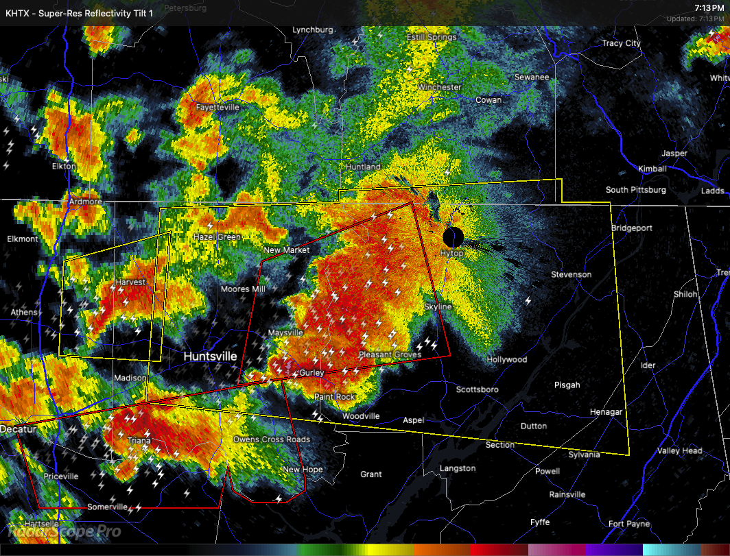
At 7:12 PM CDT, a severe thunderstorm was located near Harvest, or 7 miles northwest of Madison, moving east at 40 miles per hour. Radar indicated the storm is capable of producing wind gusts up to 60 miles per hour and quarter size hail.
Hail damage to vehicles is expected, along with possible damage to roofs, siding, and trees.
Locations in the path of this storm include French Mill, Toney, Capshaw, Harvest, Madison, Athens, and Huntsville.
Remain alert for a possible tornado, as they can develop quickly from severe thunderstorms. If a tornado is spotted, seek shelter immediately in a basement or small central room of a sturdy structure. For your protection, move to an interior room on the lowest floor of a building.
A Tornado Watch remains in effect until 10:00 PM CDT for north central, northeastern, and northwestern Alabama, as well as Middle Tennessee.
Category: Alabama's Weather, ALL POSTS, Severe Weather, Social Media
About the Author (Author Profile)
Scott Martin is an operational meteorologist, professional graphic artist, musician, husband, and father. Not only is Scott a member of the National Weather Association, but he is also the Central Alabama Chapter of the NWA president. Scott is also the co-founder of Racecast Weather, which provides forecasts for many racing series across the USA. He also supplies forecasts for the BassMaster Elite Series events including the BassMaster Classic.Subscribe
If you enjoyed this article, subscribe to receive more just like it.


