Tornado Warning for Northeastern Marshall, Southern Jackson, Southeastern Madison, and Central DeKalb Counties Until 8:45 PM CDT
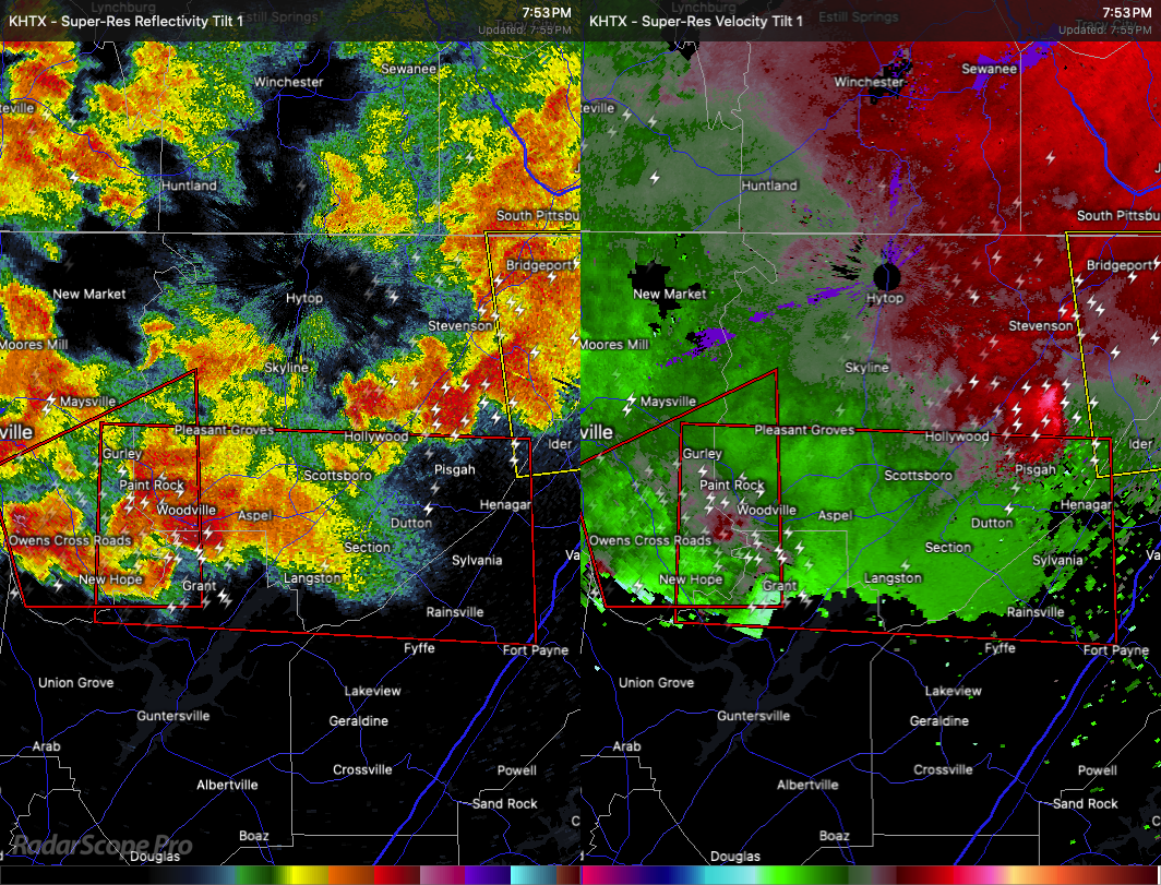
A potentially tornadic storm is moving through northeastern Alabama this evening. At 7:53 PM CDT, a severe thunderstorm with strong rotation was located near Woodville, about 15 miles north of Guntersville, moving east at 35 miles per hour.
This storm may quickly produce a tornado and is also capable of dropping golf ball size hail. If a tornado touches down, it could cause serious damage. Flying debris will be dangerous to anyone without shelter. Mobile homes could be destroyed, and damage to roofs, windows, vehicles, and trees is likely.
The storm is expected to reach Woodville and Grant around 8:00 PM, Scottsboro by 8:10 PM, Section by 8:15 PM, Powell by 8:25 PM, and Sylvania around 8:30 PM. Henagar and Rainsville could be affected around 8:35 PM. Other communities in the path include Dutton, Paint Rock, Langston, Lim Rock, Rosalie, Pleasant Groves, Garth, Larkinsville, and Pine Ridge.
If you are in the warning area, take shelter immediately. Move to a basement or an interior room on the lowest floor of a well-built structure. Stay away from windows. If you’re outside, in a vehicle, or in a mobile home, get to a safe place right away and protect yourself from flying debris.
Category: Alabama's Weather, ALL POSTS, Severe Weather, Social Media
About the Author (Author Profile)
Scott Martin is an operational meteorologist, professional graphic artist, musician, husband, and father. Not only is Scott a member of the National Weather Association, but he is also the Central Alabama Chapter of the NWA president. Scott is also the co-founder of Racecast Weather, which provides forecasts for many racing series across the USA. He also supplies forecasts for the BassMaster Elite Series events including the BassMaster Classic.Subscribe
If you enjoyed this article, subscribe to receive more just like it.


