Severe Thunderstorm Warning for Franklin and Southwestern Lawrence Counties Until 9:00 PM CDT
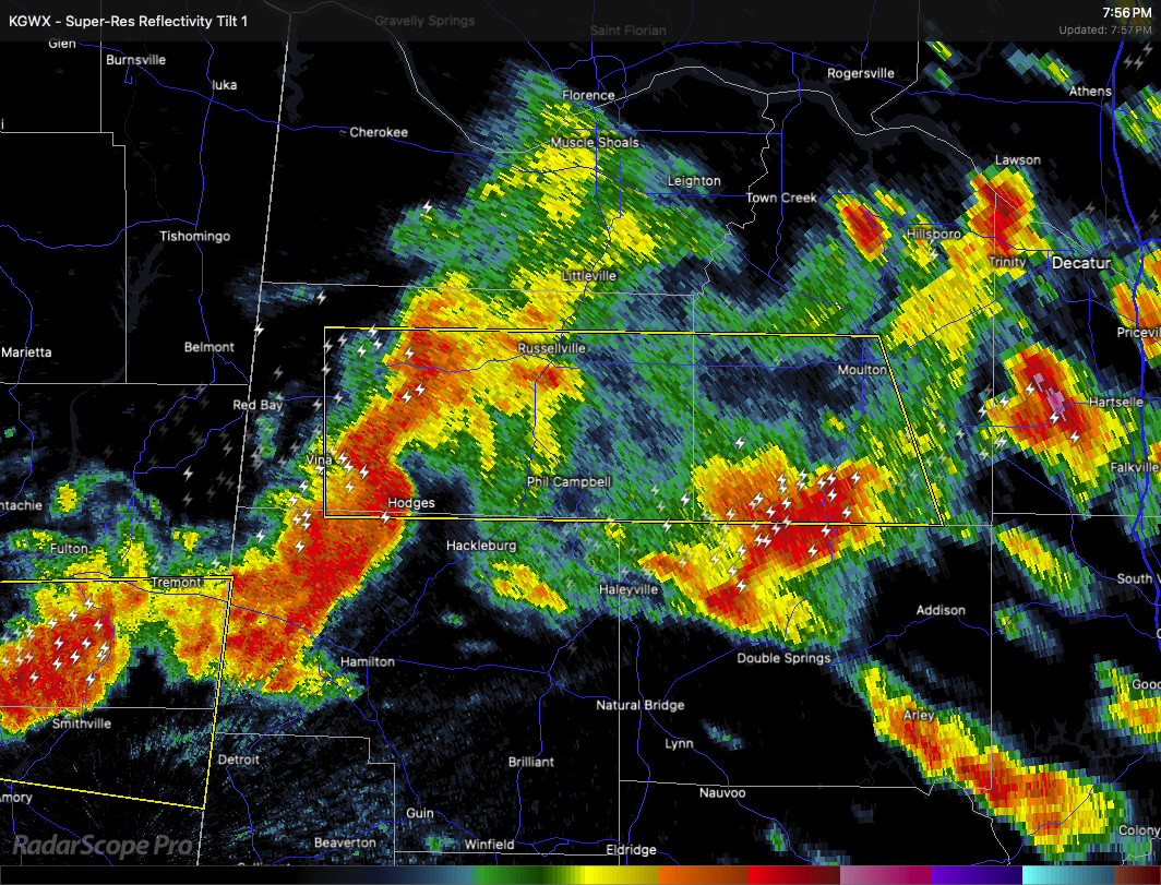
A strong thunderstorm is moving through parts of northwestern Alabama this evening. At 7:55 PM CDT, a severe storm was located about 8 miles northwest of Hackleburg, or 12 miles north of Hamilton, and was moving east at 45 miles per hour.
This storm is capable of producing wind gusts up to 60 miles per hour and quarter-size hail. These conditions may damage vehicles, roofs, siding, and trees.
Areas that may be affected include Russellville, Mt Hope, Cedar Creek Reservoir, Atwood, Tharptown, Duketon, Rockwood, Wren, Landersville, and Hodges.
If you are in the path of this storm, take shelter in an interior room on the lowest floor of a sturdy building. A Tornado Watch remains in effect until 10:00 PM CDT for much of north central and northwestern Alabama. Stay alert in case conditions worsen.
Category: Alabama's Weather, ALL POSTS, Severe Weather, Social Media
About the Author (Author Profile)
Scott Martin is an operational meteorologist, professional graphic artist, musician, husband, and father. Not only is Scott a member of the National Weather Association, but he is also the Central Alabama Chapter of the NWA president. Scott is also the co-founder of Racecast Weather, which provides forecasts for many racing series across the USA. He also supplies forecasts for the BassMaster Elite Series events including the BassMaster Classic.Subscribe
If you enjoyed this article, subscribe to receive more just like it.


