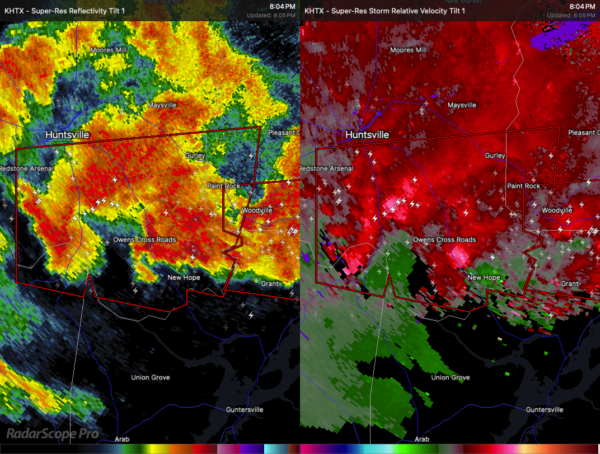
Tornado Warning for Southwestern Jackson, Southeastern Madison, and Northeastern Morgan Counties Until 8:30 PM CDT
A severe thunderstorm capable of producing a tornado is moving through parts of northeastern and north central Alabama this evening. At 8:04 PM CDT, a storm showing rotation was located near Redstone Arsenal, traveling east at 45 miles per hour.
This storm could produce a tornado and hail up to quarter size. Flying debris will be dangerous to anyone caught without shelter. Mobile homes may be destroyed, and damage to roofs, windows, vehicles, and trees is likely.
The storm is expected to reach Owens Cross Roads and Huntsville around 8:10 PM, and Woodville around 8:20 PM. Other locations in the path include Paint Rock, Garth, Hampton Cove, Laceys Spring, Farley, and Whitesburg.
If you are in the warning area, take cover immediately. Go to a basement or an interior room on the lowest floor of a sturdy building, and avoid windows. If you are outside, in a vehicle, or in a mobile home, get to the nearest safe shelter and protect yourself from flying debris.
Category: Alabama's Weather, ALL POSTS, Severe Weather, Social Media


