Severe Thunderstorm Warning for Southwestern Madison and Central Morgan Counties Until 9:00 PM CDT
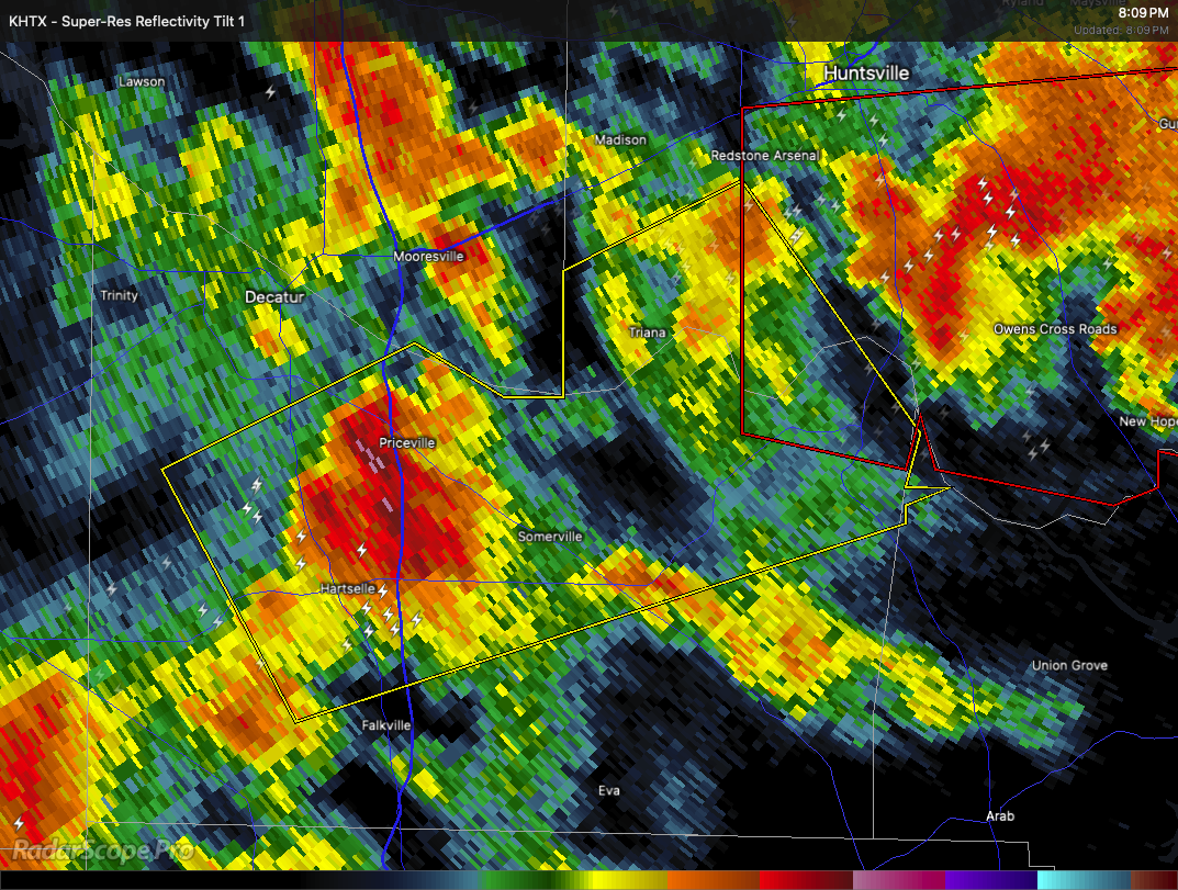
A severe thunderstorm is moving through parts of north central Alabama this evening. At 8:08 PM CDT, the storm was located over Hartselle, moving northeast at 35 miles per hour.
This storm may produce wind gusts up to 60 miles per hour and hail about the size of quarters. These conditions can cause damage to vehicles, roofs, siding, and trees.
Communities in the path include Hartselle, Priceville, Laceys Spring, Valhermoso Springs, Triana, Marshall Space Flight Center, Basham, Redstone Arsenal, Somerville, and Falkville.
If you are in this area, move to an interior room on the lowest floor of a sturdy building to stay safe. A Tornado Watch is still in effect until 10:00 PM CDT for much of north central, northeastern, and northwestern Alabama as well as parts of Middle Tennessee. Stay alert for any updates.
Category: Alabama's Weather, ALL POSTS, Severe Weather, Social Media
About the Author (Author Profile)
Scott Martin is an operational meteorologist, professional graphic artist, musician, husband, and father. Not only is Scott a member of the National Weather Association, but he is also the Central Alabama Chapter of the NWA president. Scott is also the co-founder of Racecast Weather, which provides forecasts for many racing series across the USA. He also supplies forecasts for the BassMaster Elite Series events including the BassMaster Classic.Subscribe
If you enjoyed this article, subscribe to receive more just like it.


