Tornado Warning for Eastern Jackson and Northeastern DeKalb Counties Until 8:45 PM CDT
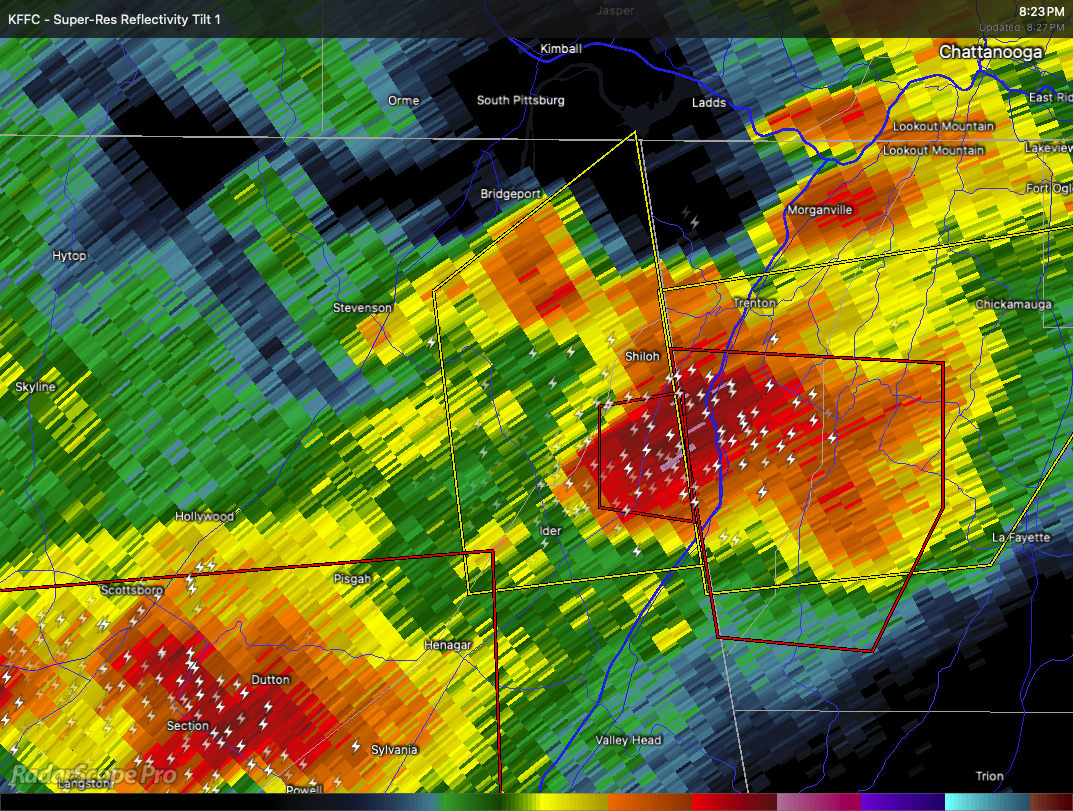
A severe thunderstorm capable of producing a tornado is moving through rural parts of northeastern Alabama. At 8:25 PM CDT, the storm was located about 7 miles northeast of Ider and 8 miles southwest of Trenton, moving east at 25 miles per hour.
This storm poses a serious threat with the potential to produce a tornado. Flying debris will be dangerous to anyone caught without shelter. Mobile homes could be damaged or destroyed, and roofs, windows, vehicles, and trees may sustain damage.
If you are in eastern Jackson or northeastern DeKalb County, take cover immediately. Move to a basement or an interior room on the lowest floor of a sturdy building and stay away from windows. If you are outside, in a mobile home, or in a vehicle, get to the closest substantial shelter right away and protect yourself from flying debris.
Category: Alabama's Weather, ALL POSTS, Severe Weather, Social Media
About the Author (Author Profile)
Scott Martin is an operational meteorologist, professional graphic artist, musician, husband, and father. Not only is Scott a member of the National Weather Association, but he is also the Central Alabama Chapter of the NWA president. Scott is also the co-founder of Racecast Weather, which provides forecasts for many racing series across the USA. He also supplies forecasts for the BassMaster Elite Series events including the BassMaster Classic.Subscribe
If you enjoyed this article, subscribe to receive more just like it.


