Severe Thunderstorm Warning for Northwestern Marshall, Southwestern Madison, Northern Cullman, and Southeastern Morgan Counties Until 9:00 PM CDT
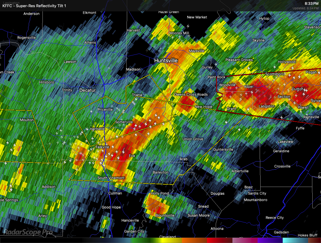
A line of severe thunderstorms is moving east through parts of northeastern and north central Alabama. At 8:32 PM CDT, storms were located from about 7 miles south of Triana to 6 miles southwest of Falkville, advancing east at 40 miles per hour.
These storms are producing wind gusts up to 60 miles per hour and hail the size of quarters. This weather can cause damage to vehicles, roofs, siding, and trees.
Communities in the path include Baileyton, Valhermoso Springs, Falkville, Arab, Hulaco, Columbus City, Cole Springs, Battleground, Morgan City, and Eva.
If you are in the warning area, take shelter inside an interior room on the lowest floor of a sturdy building. A Tornado Watch remains in effect until 10:00 PM CDT for much of north central, northeastern, and northwestern Alabama. Stay alert for any further updates.
Category: Alabama's Weather, ALL POSTS, Severe Weather, Social Media
About the Author (Author Profile)
Scott Martin is an operational meteorologist, professional graphic artist, musician, husband, and father. Not only is Scott a member of the National Weather Association, but he is also the Central Alabama Chapter of the NWA president. Scott is also the co-founder of Racecast Weather, which provides forecasts for many racing series across the USA. He also supplies forecasts for the BassMaster Elite Series events including the BassMaster Classic.Subscribe
If you enjoyed this article, subscribe to receive more just like it.


