Mesoscale Discussion: Severe Storms Possible in Eastern Mississippi and Southern Alabama
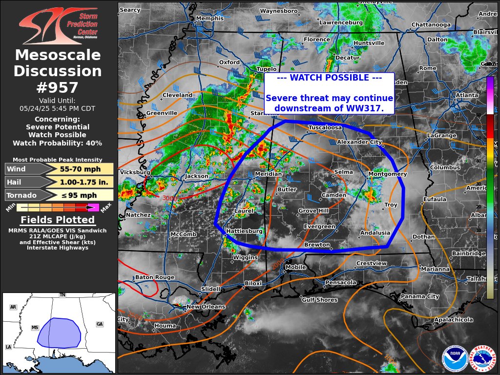
A line of strong to severe thunderstorms continues moving southeastward out of central Mississippi, with new storm development noted along an advancing outflow boundary. Some of these newer storms have already produced quarter-size hail.
While there’s uncertainty about how long the primary line of storms will hold together, especially as it pushes away from stronger upper-level support, the atmosphere downstream across southeastern Mississippi and into southern Alabama remains very unstable. Temperatures are hot, and surface-based instability is high — with MLCAPE values near 2500 J/kg.
If the storms can maintain a cold pool and stay somewhat organized, damaging winds could remain a threat this evening across parts of southern and central Alabama. Whether a new watch will be issued is uncertain at this time, but the situation is being closely monitored. There’s about a 40 percent chance that a new Severe Thunderstorm Watch could be needed for the area.
Stay alert for updates if you’re in this region, and be ready to take shelter if warnings are issued.
Category: Alabama's Weather, ALL POSTS, Severe Weather, Social Media
About the Author (Author Profile)
Scott Martin is an operational meteorologist, professional graphic artist, musician, husband, and father. Not only is Scott a member of the National Weather Association, but he is also the Central Alabama Chapter of the NWA president. Scott is also the co-founder of Racecast Weather, which provides forecasts for many racing series across the USA. He also supplies forecasts for the BassMaster Elite Series events including the BassMaster Classic.Subscribe
If you enjoyed this article, subscribe to receive more just like it.


