Severe Thunderstorm Watch Expanded to Include Western and Central Alabama Counties
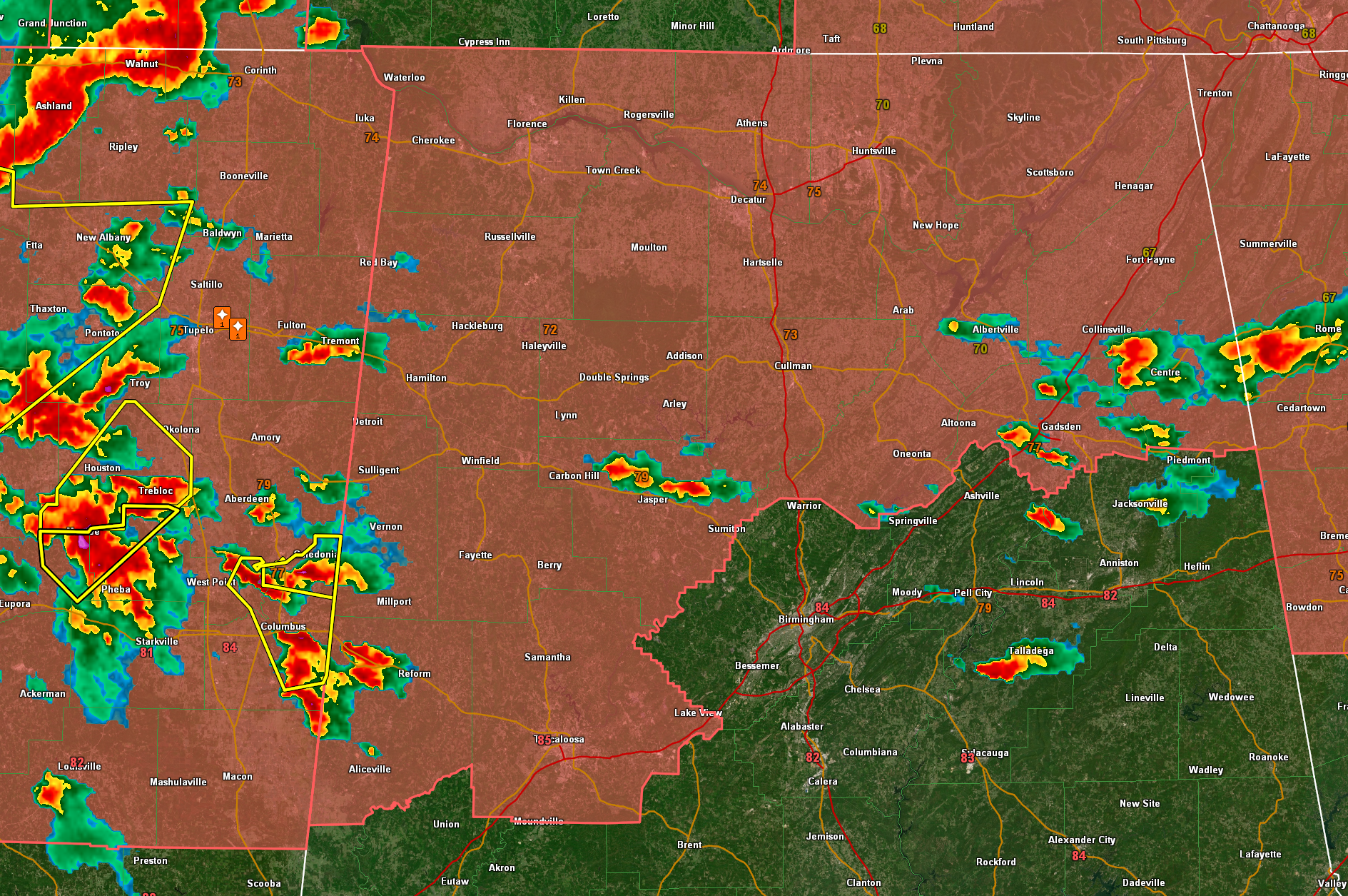
Severe Thunderstorm Watch 324 has been expanded by the National Weather Service to include additional counties in west and central Alabama. The watch is now in effect for Fayette, Lamar, Marion, Pickens, Tuscaloosa, Walker, and Winston counties until 11 PM CDT this evening. This is in addition to the existing watch already in effect for Blount, Cherokee, and Etowah counties.
Storms are increasing tonight across West Alabama, especially across Pickens and getting ready to move into Lamar County.
Back to the west the storms over Mississippi are really increasing too and we will deal with those later.
Residents in the watch area should remain weather aware as storms moving across northern and central Alabama this evening may produce damaging winds up to 70 mph and large hail. Be ready to take shelter quickly if warnings are issued. The expanded watch area includes the cities of Tuscaloosa, Hamilton, Jasper, Haleyville, Vernon, Fayette, Aliceville, Gadsden, Oneonta, and Centre.
Category: Alabama's Weather, ALL POSTS, Severe Weather, Social Media
About the Author (Author Profile)
Bill Murray is the President of The Weather Factory. He is the site's official weather historian and a weekend forecaster. He also anchors the site's severe weather coverage. Bill Murray is the proud holder of National Weather Association Digital Seal #0001 @wxhistorianSubscribe
If you enjoyed this article, subscribe to receive more just like it.


