Severe Thunderstorm Warning for Hale and Marengo Counties Until 11:30 PM
Storms across most of Alabama have weakened considerably tonight, but a more intense portion of the line is pushing through parts of the southern counties.
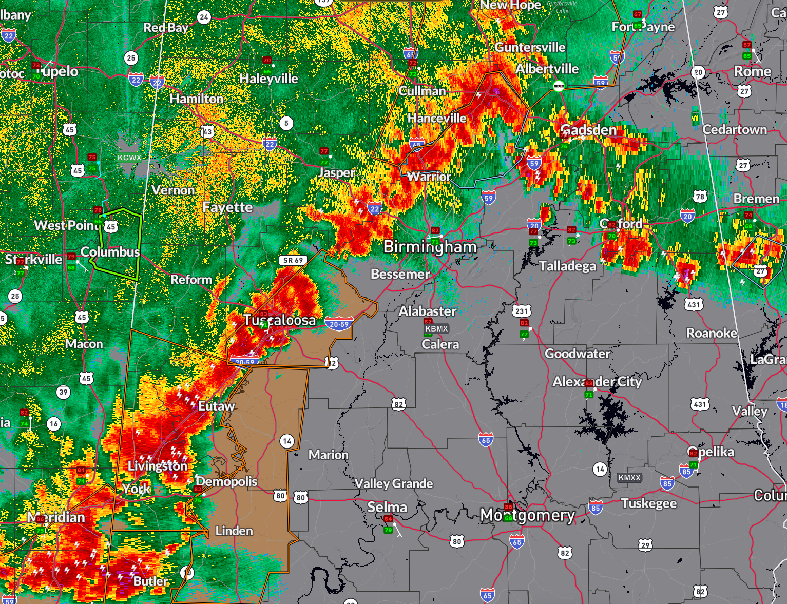
At 10:24 PM, the National Weather Service issued a Severe Thunderstorm Warning for Hale and Marengo counties.
A line of strong storms extended from near Knoxville to near Kinterbish, moving east at 45 mph. Hazards include 60 mph wind gusts and quarter-size hail. Communities impacted include Demopolis, Greensboro, Linden, Moundville, Sweet Water, and Akron.
There are severe thunderstorm warnings up north for parts of Cullman, Morgan, Madison, Marshall, Jackson, and DeKalb counties.
Storms are approaching the Birmingham area but are not severe.
There is a severe thunderstorm warning for eastern Tuscaloosa County, but I doubt that will be extended eastward.
Then we get into the stronger storms over Hale, Marengo and Choctaw counties.
Category: Alabama's Weather, ALL POSTS, Severe Weather, Social Media
About the Author (Author Profile)
Bill Murray is the President of The Weather Factory. He is the site's official weather historian and a weekend forecaster. He also anchors the site's severe weather coverage. Bill Murray is the proud holder of National Weather Association Digital Seal #0001 @wxhistorianSubscribe
If you enjoyed this article, subscribe to receive more just like it.


