Alabama Weather Update at 3:30: Warnings From Scattered Storms
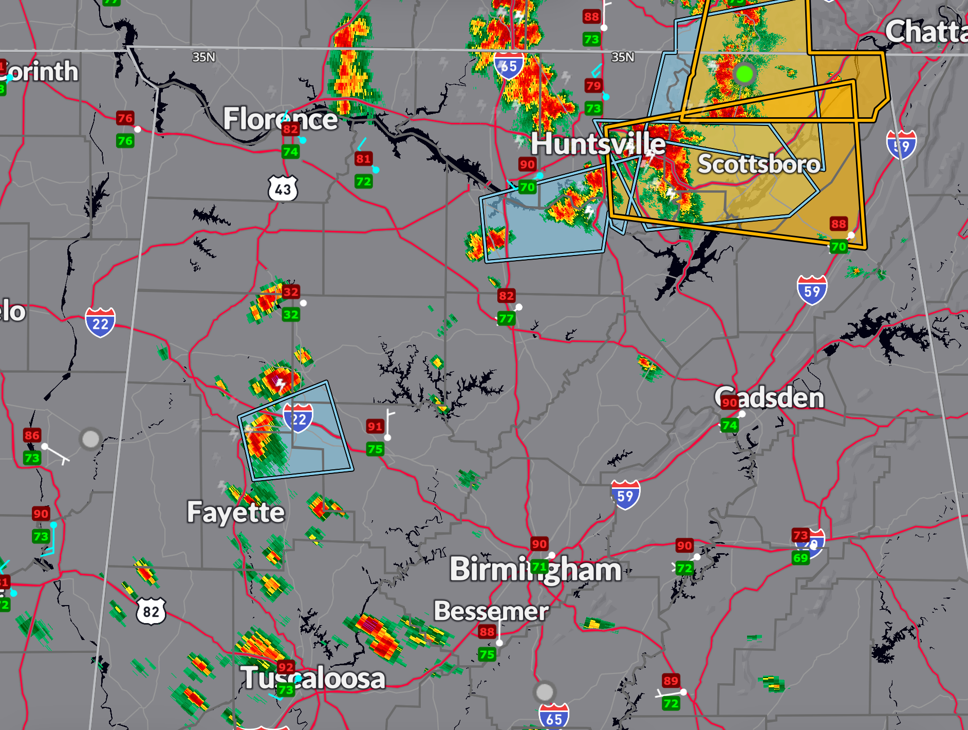
Two severe thunderstorm warnings in effect for North Alabama now…
…until 4:15 for Jackson County as well as Franklin Co. in Tennessee.
…until 4:15 for DeKalb, Jackson, Madison, and Marshall counties.
The blue polygons are significant weather advisories for strong storms that aren’t severe.
Storms continue to develop this afternoon across northern Mississippi and are gradually pushing into parts of northeastern Alabama. There’s plenty of instability in place—temperatures are warm, dewpoints are high, and the atmosphere is ripe for strong convection—but there’s not much in the way of a strong trigger to organize widespread severe weather. A weak mid-level disturbance is present to our north, and some storms in the Tennessee Valley have been more robust under that influence.
Closer to Central Alabama, a remnant MCV and outflow boundary are moving southeastward, helping to spark some scattered storms. As they tap into the unstable air, some of these could pulse up and produce damaging wind gusts of 55–70 mph and hail up to quarter size. Shear is weak, so organization will be limited, and a watch is not expected. Still, we’ll be monitoring closely for any stronger storm cells that manage to intensify this evening.
Category: Alabama's Weather, ALL POSTS, Severe Weather, Social Media
About the Author (Author Profile)
Bill Murray is the President of The Weather Factory. He is the site's official weather historian and a weekend forecaster. He also anchors the site's severe weather coverage. Bill Murray is the proud holder of National Weather Association Digital Seal #0001 @wxhistorianSubscribe
If you enjoyed this article, subscribe to receive more just like it.


