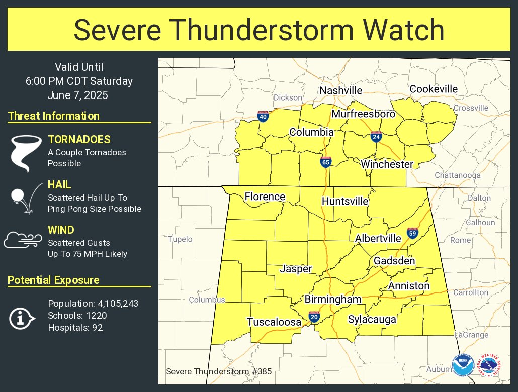
Severe Thunderstorm Watch Until 6 p.m. For Northern Half of Alabama
The SPC and NWS offices in Birmingham and surrounding areas have issued a severe thunderstorm watch for this afternoon.
A dangerous line of thunderstorms is advancing steadily toward Alabama this afternoon, with strong to severe storms expected to impact northern and central parts of the state through the evening. This activity is tied to a well-organized mesoscale convective system (MCS) currently pushing east from the Mid-South, fueled by a potent midlevel shortwave and a very moist, unstable air mass. As temperatures climb into the 80s and dewpoints hold in the low to mid 70s, instability values across Alabama will exceed 2000 J/kg—more than sufficient to support damaging wind gusts, isolated large hail, and perhaps a brief tornado or two.
Storms are expected to reach northwest Alabama between 12 and 1 PM and progress east and southeast through the afternoon. Locations such as Birmingham, Tuscaloosa, Anniston, and Gadsden could see strong to severe storms by mid- to late afternoon. Gusts as high as 75 mph will be possible, particularly with embedded circulations within the line. There’s also some potential for additional storm development later tonight along outflow boundaries, especially over west and southwest Alabama. Storms are forecast to gradually weaken as they push toward eastern Alabama this evening. Stay weather aware and monitor warnings closely throughout the day.
Category: Alabama's Weather, ALL POSTS, Severe Weather, Social Media
About the Author (Author Profile)
Bill Murray is the President of The Weather Factory. He is the site's official weather historian and a weekend forecaster. He also anchors the site's severe weather coverage. Bill Murray is the proud holder of National Weather Association Digital Seal #0001 @wxhistorianSubscribe
If you enjoyed this article, subscribe to receive more just like it.


