Increasing Risk of Damaging Winds Across Northern Alabama and Far Northeastern Mississippi
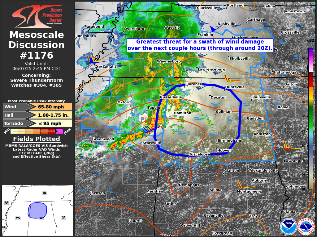
The Storm Prediction Center has issued Mesoscale Discussion 1176, highlighting a growing risk for severe weather across parts of northern Alabama and far northeastern Mississippi in association with Severe Thunderstorm Watches 384 and 385.
As of 12:45 PM CDT, radar shows a strengthening line of storms — known as a mesoscale convective system (MCS) — moving east at around 40 knots from far northeastern Mississippi into northern Alabama. This line is being supported by a strong and organizing cold pool and favorable wind shear (30–40 knots of shear in the lower and mid-levels), which is allowing the storms to maintain intensity and structure.
Conditions ahead of the line remain unstable, with surface dewpoints in the lower 70s helping to fuel continued development. As this system progresses eastward into northern Alabama and southern Middle Tennessee, the primary concern will be a swath of damaging straight-line winds, with some embedded gusts possibly reaching up to 75 mph.
While the dominant threat is damaging wind, a brief and isolated tornado cannot be ruled out—particularly in any small-scale circulations (mesovortices) that develop along the leading edge of the storm line.
Residents in the affected areas should stay alert, monitor warnings closely, and be prepared to seek shelter if necessary. The threat is expected to persist through at least 3 PM CDT (20Z).
Category: Alabama's Weather, ALL POSTS, Severe Weather, Social Media
About the Author (Author Profile)
Scott Martin is an operational meteorologist, professional graphic artist, musician, husband, and father. Not only is Scott a member of the National Weather Association, but he is also the Central Alabama Chapter of the NWA president. Scott is also the co-founder of Racecast Weather, which provides forecasts for many racing series across the USA. He also supplies forecasts for the BassMaster Elite Series events including the BassMaster Classic.Subscribe
If you enjoyed this article, subscribe to receive more just like it.


