Severe Thunderstorm Warning for Walker and Winston Counties Until 2:15 PM CDT
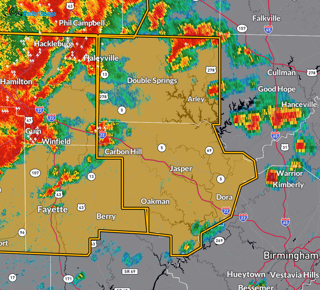
At 1:01 PM CDT, the National Weather Service in Birmingham issued a Severe Thunderstorm Warning for central and northwestern Alabama, including Walker and Winston counties. A line of severe thunderstorms was located extending from near Hackleburg to near Gu-Win to 7 miles east of Caledonia, moving east at 60 mph.
These storms are capable of producing wind gusts up to 70 mph and penny-sized hail. Radar has indicated these hazards are ongoing. Expect considerable tree damage, along with potential damage to mobile homes, roofs, and outbuildings.
Areas in the path of these storms include Jasper, Haleyville, Sumiton, Cordova, Dora, Carbon Hill, Lynn, Arley, Double Springs, Parrish, Oakman, Addison, Sipsey, West Jefferson, Kansas, Nauvoo, Eldridge, Curry, Houston Recreational Area, and Camp McDowell.
If you are in the warned area, take shelter immediately in an interior room on the lowest floor of a sturdy building. Avoid windows and remain weather aware. This warning remains in effect until 2:15 PM CDT.
Category: Alabama's Weather, ALL POSTS, Severe Weather
About the Author (Author Profile)
Scott Martin is an operational meteorologist, professional graphic artist, musician, husband, and father. Not only is Scott a member of the National Weather Association, but he is also the Central Alabama Chapter of the NWA president. Scott is also the co-founder of Racecast Weather, which provides forecasts for many racing series across the USA. He also supplies forecasts for the BassMaster Elite Series events including the BassMaster Classic.Subscribe
If you enjoyed this article, subscribe to receive more just like it.


