Severe Thunderstorm Warning for Pickens County Until 2:15 PM CDT
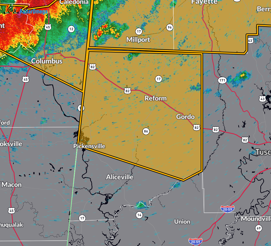
At 1:04 PM CDT, the National Weather Service in Birmingham issued a Severe Thunderstorm Warning for west central Alabama, specifically Pickens County. A line of severe thunderstorms was located from about 7 miles northwest of Millport to near Artesia, moving east at 55 mph.
These storms are producing wind gusts up to 60 mph and penny-sized hail. Radar has indicated these hazards. Expect potential damage to roofs, siding, and trees.
Locations that may be impacted include Gordo, Reform, Carrollton, Pickensville, Ethelsville, Dillburg, North Pickens Airport, McShan, Shaw, Owens, Kirk, Pioneer, Lubbub, Macedonia, and Forest.
If you are in the path of this storm, move immediately to an interior room on the lowest floor of a sturdy building. Stay away from windows and monitor local alerts. This warning remains in effect until 2:15 PM CDT.
Category: Alabama's Weather, ALL POSTS, Severe Weather, Social Media
About the Author (Author Profile)
Scott Martin is an operational meteorologist, professional graphic artist, musician, husband, and father. Not only is Scott a member of the National Weather Association, but he is also the Central Alabama Chapter of the NWA president. Scott is also the co-founder of Racecast Weather, which provides forecasts for many racing series across the USA. He also supplies forecasts for the BassMaster Elite Series events including the BassMaster Classic.Subscribe
If you enjoyed this article, subscribe to receive more just like it.


