Severe Thunderstorm Warning for Portions of Madison, Limestone, Lauderdale, Colbert, Cullman, Franklin, Morgan, and Lawrence Counties Until 2:15 PM CDT
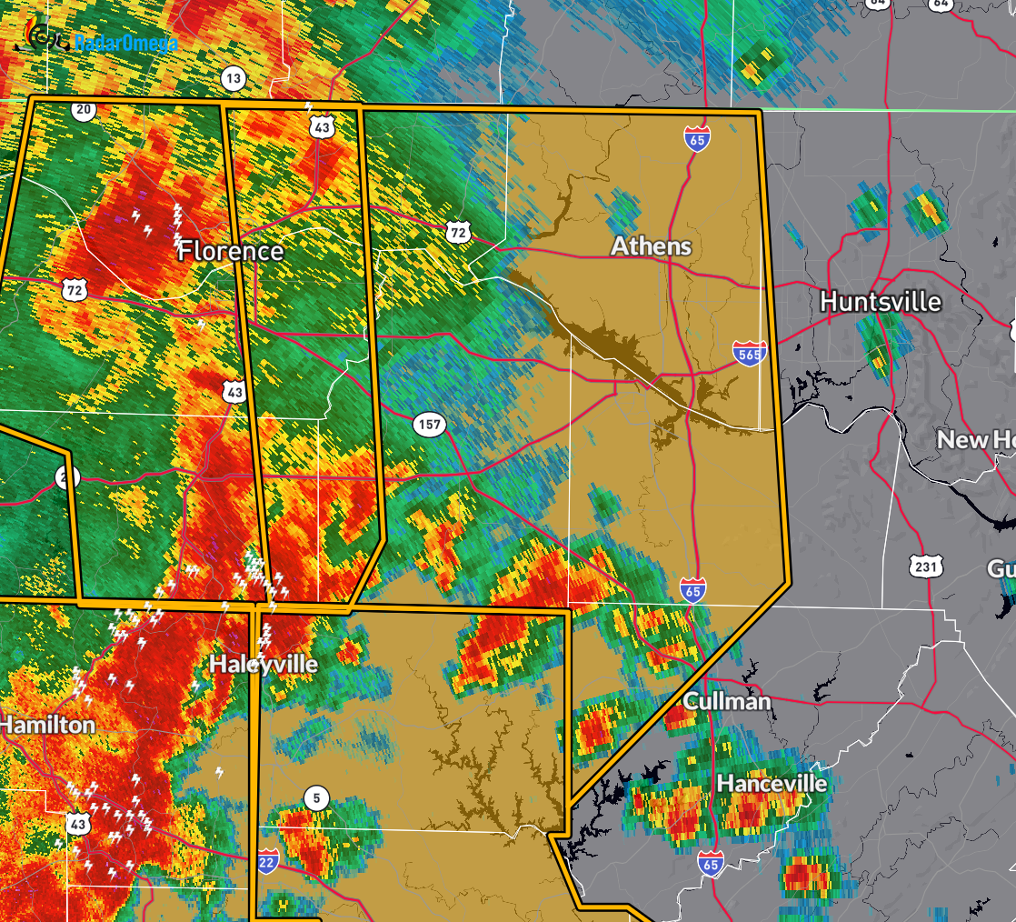
At 1:07 PM CDT, the National Weather Service in Huntsville issued a Severe Thunderstorm Warning for parts of north central and northwestern Alabama, including west central Madison County, Limestone County, eastern Lauderdale County, southeastern Colbert County, northwestern Cullman County, eastern Franklin County, Morgan County, and Lawrence County.
A line of severe thunderstorms was located from near Littleville to near Lake Buttahatchee to near Bluff, moving east at 45 mph.
These storms are producing wind gusts up to 60 mph. Radar indicates the threat is ongoing. Damaging winds may lead to roof, siding, and tree damage.
Locations likely to be impacted include Decatur, Madison, Florence, Athens, Hartselle, Muscle Shoals, Moulton, Priceville, Trinity, and Falkville.
Residents in the path of this storm should take immediate shelter in an interior room on the lowest floor of a sturdy building. Avoid windows and stay tuned to weather alerts. This warning remains in effect until 2:15 PM CDT.
Category: Alabama's Weather, ALL POSTS, Severe Weather, Social Media
About the Author (Author Profile)
Scott Martin is an operational meteorologist, professional graphic artist, musician, husband, and father. Not only is Scott a member of the National Weather Association, but he is also the Central Alabama Chapter of the NWA president. Scott is also the co-founder of Racecast Weather, which provides forecasts for many racing series across the USA. He also supplies forecasts for the BassMaster Elite Series events including the BassMaster Classic.Subscribe
If you enjoyed this article, subscribe to receive more just like it.


