Severe Thunderstorm Warning for Tuscaloosa and Fayette Counties Until 2:45 PM CDT
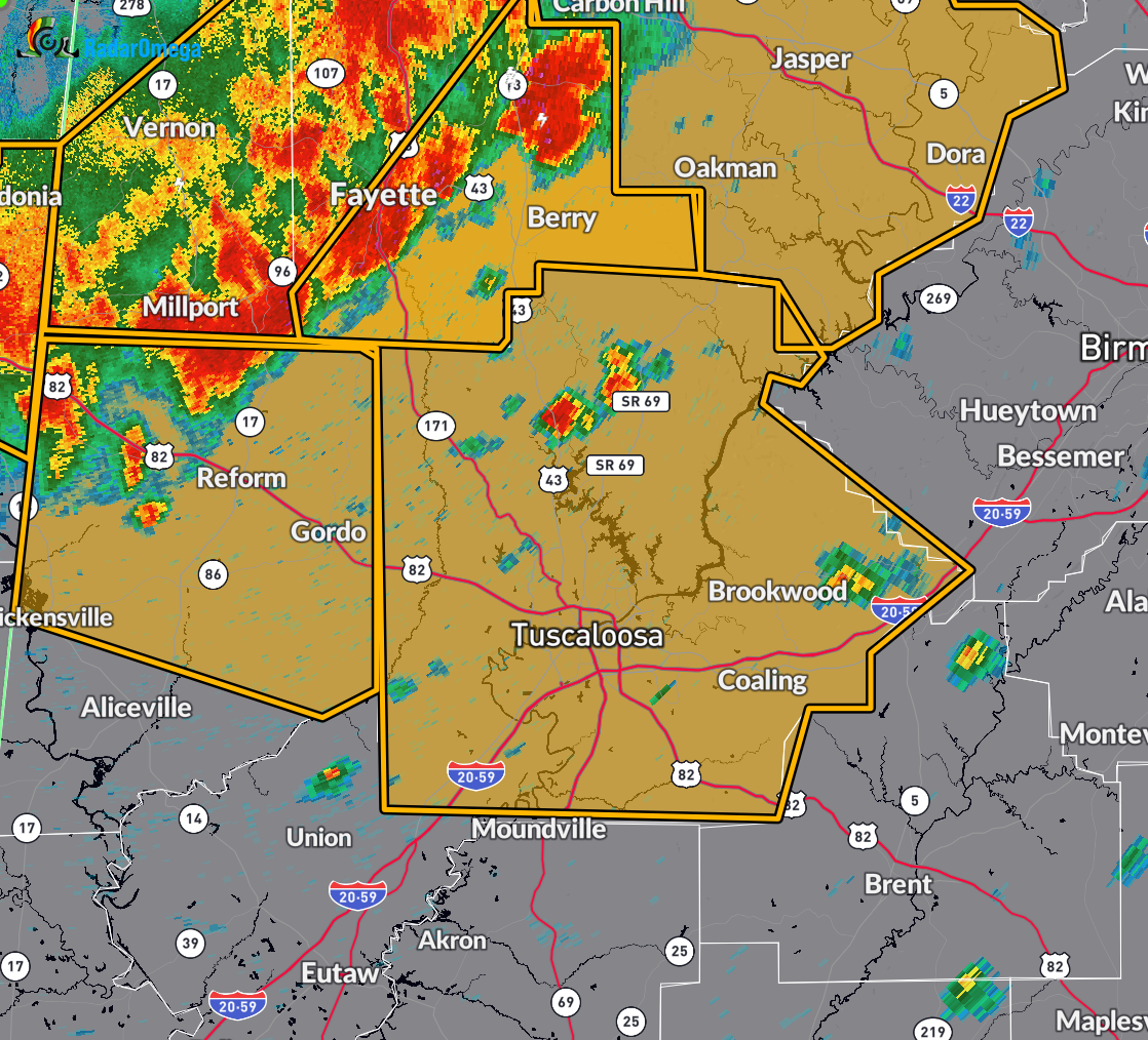
At 1:24 PM CDT, the National Weather Service in Birmingham issued a Severe Thunderstorm Warning for west central Alabama, including Tuscaloosa and Fayette counties. A line of severe thunderstorms was located extending from near Eldridge to Ashcraft Corner to near Ethelsville, moving southeast at 55 mph.
These storms are producing wind gusts up to 60 mph and penny-sized hail. Radar has confirmed these hazards. Expect damage to roofs, siding, and trees.
Locations likely to be affected include Tuscaloosa, Northport, Fayette, Holt, Lake View, Brookwood, Coaling, Vance, Berry, Coker, Samantha, McFarland Mall, Lake Lurleen State Park, Tuscaloosa Amphitheater, Tuscaloosa Regional Airport, Lake Wildwood, Boley Springs, Mercedes Benz of Alabama, Binion Creek Landing, and Bankston.
If you are in the path of this storm, move immediately to an interior room on the lowest floor of a sturdy building. Stay away from windows and remain weather aware. This warning is in effect until 2:45 PM CDT.
Category: Alabama's Weather, ALL POSTS, Severe Weather, Social Media
About the Author (Author Profile)
Scott Martin is an operational meteorologist, professional graphic artist, musician, husband, and father. Not only is Scott a member of the National Weather Association, but he is also the Central Alabama Chapter of the NWA president. Scott is also the co-founder of Racecast Weather, which provides forecasts for many racing series across the USA. He also supplies forecasts for the BassMaster Elite Series events including the BassMaster Classic.Subscribe
If you enjoyed this article, subscribe to receive more just like it.


