Severe Thunderstorm Watch Expanded in Central Alabama
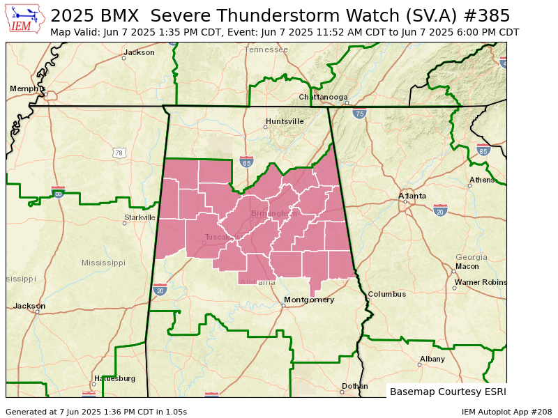
A Severe Thunderstorm Watch has been expanded and extended by the National Weather Service in Birmingham and is now in effect until 6:00 PM CDT on Saturday, June 7, 2025, for a large portion of central and northern Alabama. The watch area now includes Bibb, Chambers, Chilton, Coosa, and Tallapoosa counties, in addition to the counties where the watch remains in effect: Blount, Calhoun, Cherokee, Clay, Cleburne, Etowah, Fayette, Jefferson, Lamar, Marion, Pickens, Randolph, Shelby, St. Clair, Talladega, Tuscaloosa, Walker, and Winston.
Severe thunderstorms moving through the region are capable of producing damaging wind gusts up to 70 mph, hail, and frequent lightning. There is also a low-end risk of an isolated tornado, especially where circulations develop along the leading edge of storm lines. Residents in the watch area should stay weather aware, monitor forecasts and warnings, and be ready to take shelter if a warning is issued for their location.
Category: Alabama's Weather, ALL POSTS, Severe Weather, Social Media
About the Author (Author Profile)
Scott Martin is an operational meteorologist, professional graphic artist, musician, husband, and father. Not only is Scott a member of the National Weather Association, but he is also the Central Alabama Chapter of the NWA president. Scott is also the co-founder of Racecast Weather, which provides forecasts for many racing series across the USA. He also supplies forecasts for the BassMaster Elite Series events including the BassMaster Classic.Subscribe
If you enjoyed this article, subscribe to receive more just like it.


