Severe Thunderstorm Warning for Blount and Jefferson Counties Until 3:00 PM CDT
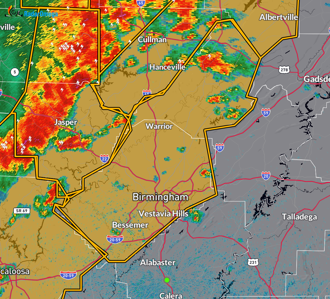
At 1:46 PM CDT, the National Weather Service in Birmingham issued a Severe Thunderstorm Warning for central Alabama, including Blount and Jefferson counties. A fast-moving line of severe thunderstorms was located stretching from Addison to Jasper to Oakman to near Binion Creek Landing, moving east at 65 mph.
These storms are producing wind gusts up to 70 mph and penny-sized hail, as indicated by radar. This is a dangerous situation, with the potential for considerable tree damage, and damage likely to mobile homes, roofs, and outbuildings.
Areas expected to be impacted include Birmingham, Hoover, Vestavia Hills, Bessemer, Homewood, Mountain Brook, Trussville, Hueytown, Gardendale, Irondale, Leeds, Moody, Fairfield, Fultondale, Oneonta, Blountsville, Cleveland, Dallas, Center Point, and Pleasant Grove.
If you are in the warned area, move immediately to an interior room on the lowest floor of a sturdy building. Stay away from windows and remain alert to further warnings. This warning remains in effect until 3:00 PM CDT.
Category: Alabama's Weather, ALL POSTS, Severe Weather, Social Media
About the Author (Author Profile)
Scott Martin is an operational meteorologist, professional graphic artist, musician, husband, and father. Not only is Scott a member of the National Weather Association, but he is also the Central Alabama Chapter of the NWA president. Scott is also the co-founder of Racecast Weather, which provides forecasts for many racing series across the USA. He also supplies forecasts for the BassMaster Elite Series events including the BassMaster Classic.Subscribe
If you enjoyed this article, subscribe to receive more just like it.


