Severe Storms Approaching the Alabama Border: Conditions Somewhat Favorable for Brief Tornado
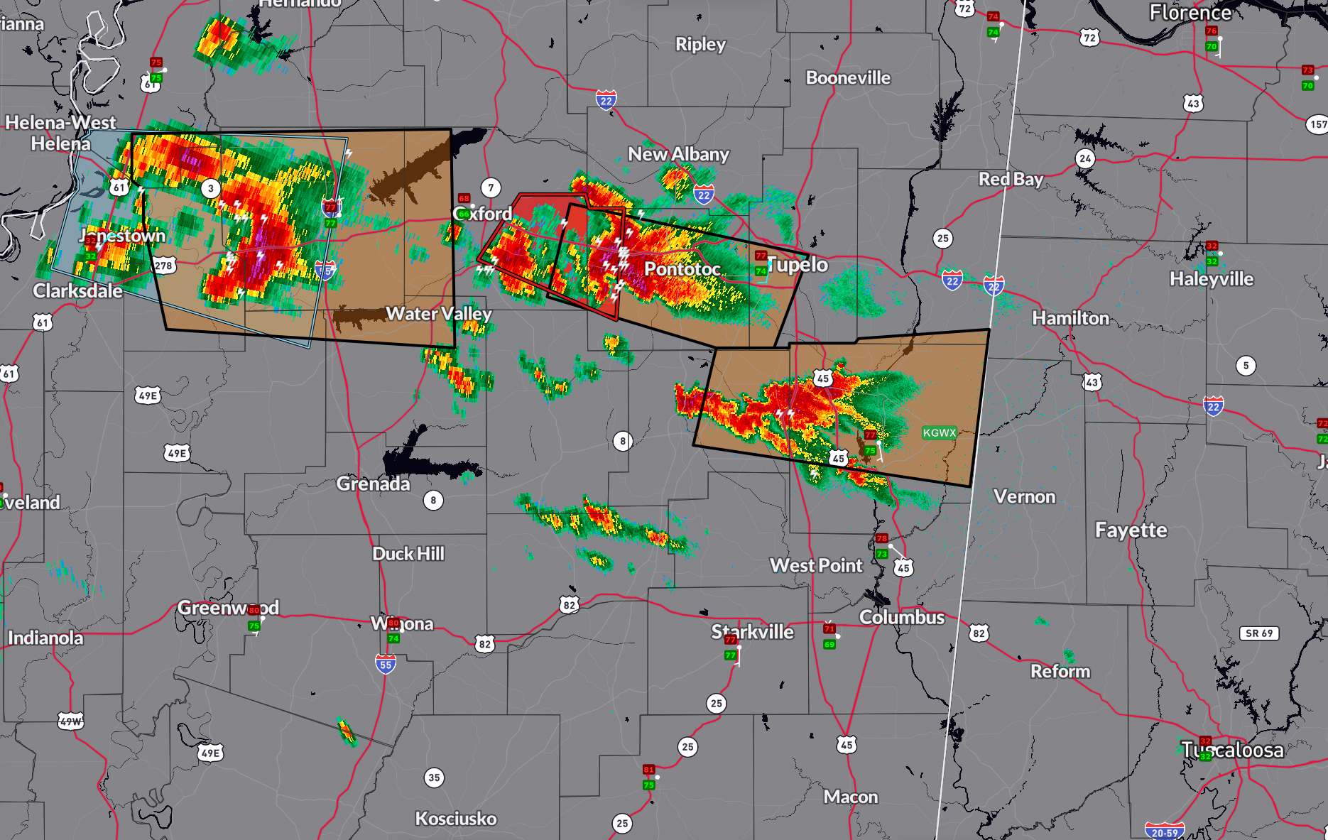
We have an intensifying storm late tonight near Okolona, MS. It has promoted a severe thunderstorm warning for Monroe and Chickasaw counties in Northeast Mississippi. The storm is moving ENE at 26 mph. It will pass near Amory and Smithville MS. Averaging about 25 lightning strikes per minute. This storm will be approaching northern Lamar and southwestern Marion County before midnight. It may produce damaging winds, small hail, and we can’t rule out a tornado.
Environmental conditions are surprising favorable for tornadoes in Northwest Alabama with 0-1 km helicity values over 250 m2/s2. This is capable of supporting a tornado.
A little further back in Mississippi, a confirmed tornado was approaching Pontotoc, MS. There was a brief tornado debris signature a short time ago. There was funnel cloud reported near Denmark in Lafayette County, MS at 10:56 p.m The NWS Memphis has just issued a downstream severe thunderstorm warning for this storm since the rotation has since weakened a bit. This storm will reach Marion County or northern Lamar County before 1 a.m. and it nears watching.
Reports are that there will likly NOT be a weather watch for Alabama with this activity. But that can change.
Category: Alabama's Weather, ALL POSTS, Severe Weather, Social Media
About the Author (Author Profile)
Bill Murray is the President of The Weather Factory. He is the site's official weather historian and a weekend forecaster. He also anchors the site's severe weather coverage. Bill Murray is the proud holder of National Weather Association Digital Seal #0001 @wxhistorianSubscribe
If you enjoyed this article, subscribe to receive more just like it.


