Flash Flood Threat Increasing for Central Alabama Early This Morning
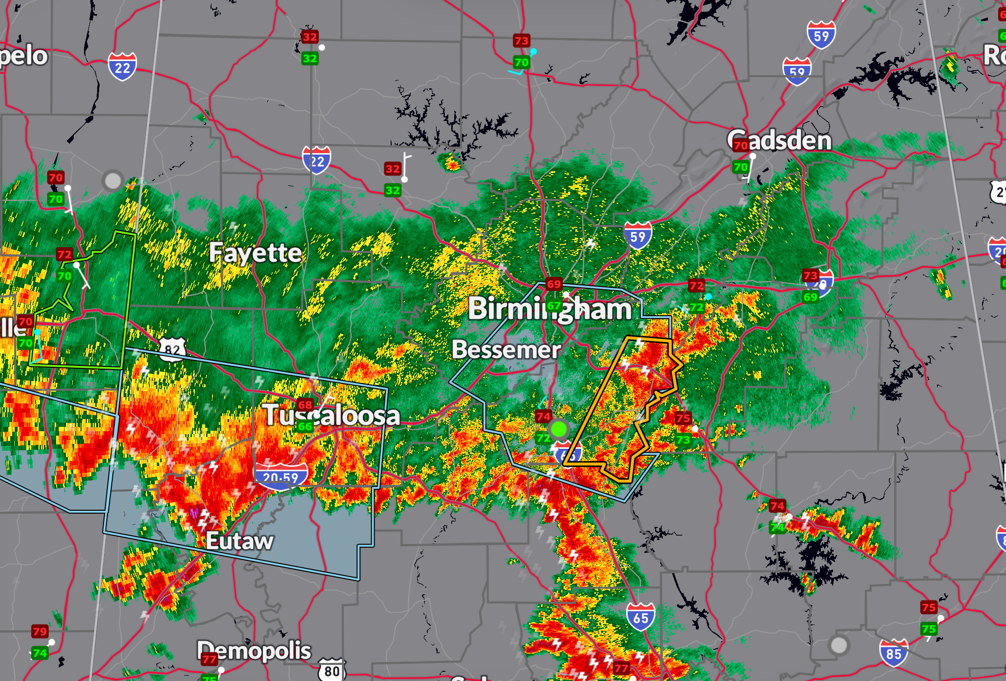
An expanding convective complex over east-central Mississippi and central Alabama is producing intense rainfall with rates of 2 to 2.5 inches per hour, according to the Weather Prediction Center.
Training and repeating thunderstorms are expected to continue through early morning, with localized totals of 2 to 4 inches possible.
The atmosphere remains highly unstable with CAPE values of 2000–2500 J/kg and very high moisture content, with PWATs near 2 inches.
Areas with recent heavy rainfall, including south of Birmingham, have flash flood guidance values low enough that additional rainfall could quickly lead to localized flash flooding.
The threat should begin to diminish toward mid-morning as storm inflow weakens.
Category: Alabama's Weather, ALL POSTS, Severe Weather, Social Media
About the Author (Author Profile)
Bill Murray is the President of The Weather Factory. He is the site's official weather historian and a weekend forecaster. He also anchors the site's severe weather coverage. Bill Murray is the proud holder of National Weather Association Digital Seal #0001 @wxhistorianSubscribe
If you enjoyed this article, subscribe to receive more just like it.


