Midday Nowcast: Mainly Quiet Radar for Now; Rain and Storms Become More Numerous in the Days Ahead
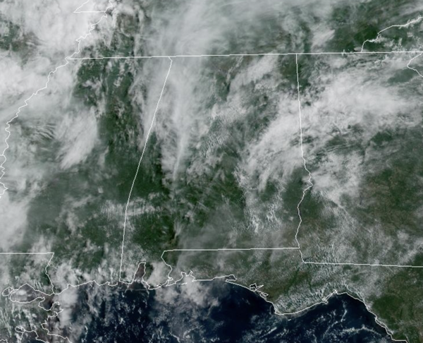
Rain chances have increased to the 40-50% range today across much of Alabama. We are seeing a partly sunny sky with highs in the mid to upper 80s. This afternoon, showers and storms will begin to increase in coverage due to daytime heating.
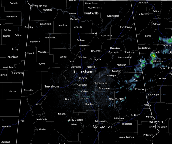
Most locations will remain dry, but locations that see the storms will receive intense tropical downpours and of course all summer storms produce frequent and dangerous lightning.
BIRMINGHAM ALMANAC: For June 12th, the average high for Birmingham is 88° and the average low is 68°. The record high is 99° set in 1977, while the record low is 53° set in 1980. We average 0.16” of precipitation on this date and the record value is 1.84” set in 1942.
HIGHER RAIN CHANCES: For tomorrow through Sunday, high moisture levels will allow rain chances increase to the 70-90%. Expect a partly sunny sky each day, with mainly afternoon/evening showers and storms across the Alabama landscape. These will be numerous to widespread, but again, not all locations will see rain. Most (but not all) of the showers and storms will occur from the 2:00 p.m. until 10:00 p.m, during the peak heating of the day.
Organized severe storms are not expected, but a random, isolated severe storm can not be ruled out. Any summer storm can produce strong gusty winds and loads of lightning, with intense tropical downpours, which could allow for isolated areas of flash flooding. In the summertime, there is no way of knowing when and where showers and storms will develop, as they are rather random. You just have to watch radar trends each day.
Highs this weekend will be in the upper 80s and dew points in the mid 70s for many locations. That is air you can wear and the combinations of heat and humidity will allow for afternoon heat index values to climb into the upper 90s and perhaps low 100s this weekend.
NEXT WEEK: Not much change; pretty routine June weather, expect with higher than normal rain chances. Expect partly sunny, humid, very warm days with scattered, mostly afternoon and evening showers and thunderstorms on a daily basis. Highs will be in the upper 80s and lower and perhaps mid 90s by the end of the week.
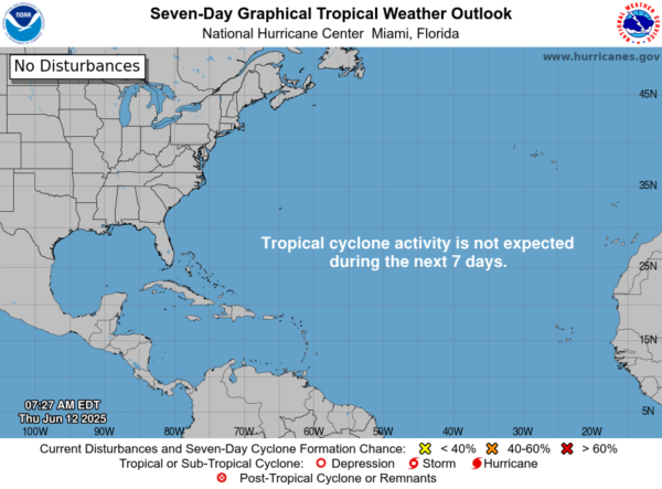
IN THE TROPICS: All is quiet and no tropical storm or hurricane development is expected in the Gulf of Mexico, Caribbean Sea, or the rest of the Atlantic the next seven days.
WORLD TEMPERATURE EXTREMES: Over the last 24 hours, the highest observation outside the U.S. was 122.0F at Jacobabad, Pakistan. The lowest observation was -84.8F at Dome A, Antarctica.
CONTIGUOUS TEMPERATURE EXTREMES: Over the last 24 hours, the highest observation was 118F at Death Valley, CA. The lowest observation was 29F at Peter Sinks, UT.
Category: Alabama's Weather, ALL POSTS, Social Media
About the Author (Author Profile)
Macon, Georgia Television Chief Meteorologist, Birmingham native, and long time Contributor on AlabamaWX. Stormchaser. I did not choose Weather, it chose Me. College Football Fanatic. @Ryan_StinnetSubscribe
If you enjoyed this article, subscribe to receive more just like it.


