Severe Thunderstorm Warning for Walker County Until 9:00 PM
The National Weather Service in Birmingham has issued a severe thunderstorm warning for Walker County in central Alabama until 9:00 PM CDT.
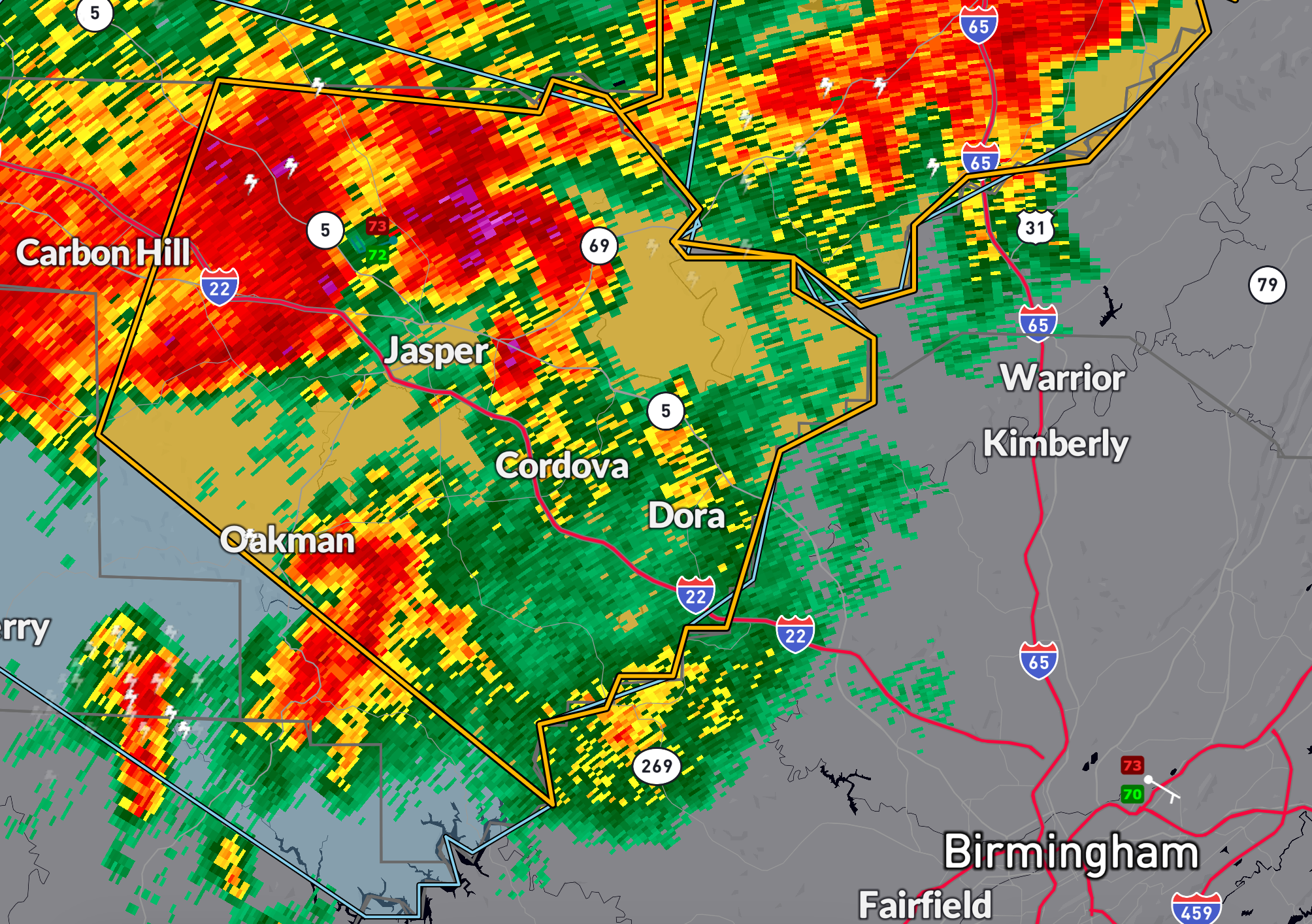
At 8:05 PM, a severe thunderstorm was located near Jasper, moving southeast at 35 mph.
This storm is producing wind gusts up to 60 mph, with radar indicating the potential for damage to roofs, siding, and trees.
Communities in the path include Jasper, Sumiton, Cordova, Dora, Parrish, Oakman, Sipsey, Curry, Gorgas Steam Plant, and Smith Dam.
Additional locations at risk are Burnwell, Beloit, Quinton, Lynns Park, Smith Lake, Empire, Cedrum Area, and Holly Grove.
Residents should seek shelter in an interior room on the lowest floor of a sturdy building.
Category: Alabama's Weather, ALL POSTS, Severe Weather, Social Media
About the Author (Author Profile)
Bill Murray is the President of The Weather Factory. He is the site's official weather historian and a weekend forecaster. He also anchors the site's severe weather coverage. Bill Murray is the proud holder of National Weather Association Digital Seal #0001 @wxhistorianSubscribe
If you enjoyed this article, subscribe to receive more just like it.


