Active Weather Continues Into Thursday; Fewer Storms & More Heat For the Weekend
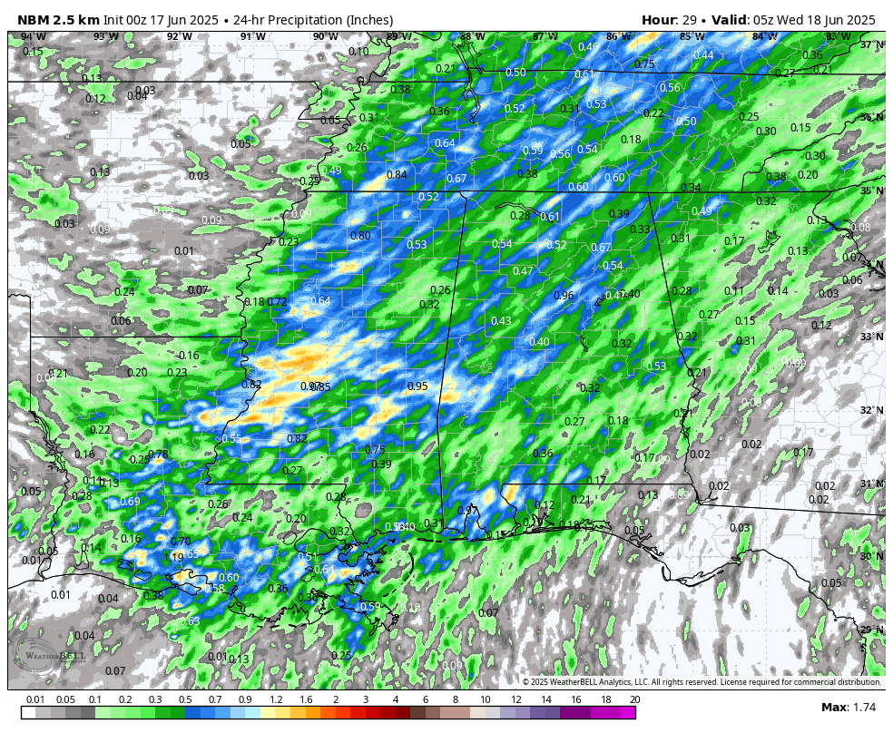
Tuesday’s projected rainfall totals (National Blend of Models).
GOOD CHANCE OF AFTERNOON STORMS THROUGH THURSDAY
Tuesday will bring a more active setup as a passing upper-level trough increases winds aloft and helps fuel numerous showers and storms through the morning and afternoon. A few of these could be on the strong side with gusty winds and small hail, especially where storms manage to repeatedly move over the same areas. Rain could be heavy at times, so flooding in isolated spots isn’t out of the question. Highs will range from the low 80s to low 90s.
On Wednesday, we’ll begin to see some drier air work into the region from the west behind the departing trough. This will gradually cut back on rain coverage from west to east, though we’ll still have scattered storms around through the afternoon. By evening, most of the state should begin drying out a bit more. Temperatures will stay on the warm side with highs in the mid 80s to low 90s.
Thursday keeps a similar pattern in place with warm, muggy conditions and hit-or-miss afternoon storms. A west-southwest flow in the atmosphere will limit storm coverage slightly, but with high humidity still locked in, it’ll feel just as hot. Expect highs once again in the mid 80s to low 90s.
FEWER STORMS, MORE HEAT THROUGH MONDAY
Friday begins the transition into a hotter, more summer-like stretch as a ridge of high pressure builds over the region. We’ll still see a few pop-up storms during the afternoon hours, but coverage will trend lower, especially north of I-20. With more sun and fewer storms, temperatures will climb into the high 80s to mid 90s.
Saturday brings the heat in full force. That ridge over the East Coast strengthens, keeping most storm chances confined to the far southern part of the state. For the rest of Central and North Alabama, expect lots of sun, hazy skies, and high humidity. Heat index values will likely push the 100-degree mark. Afternoon highs will rise into the low to mid 90s.
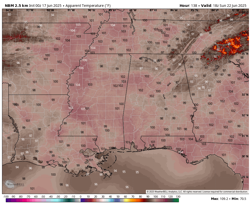
Sunday’s projected heat index values valid at 1PM (National Blend of Models).
Sunday looks to be one of the hottest days of the year so far. With little relief in the way of cloud cover or rain, temperatures will surge across the state. A few isolated storms can’t be ruled out, but most areas will stay dry and hot with highs again in the low to mid 90s.
Monday keeps the summer heat train rolling. That ridge of high pressure sticks around, and with it, only isolated storms expected during the hottest part of the day. Humidity remains high, making it feel even hotter outside. Highs will once again land in the low to mid 90s.
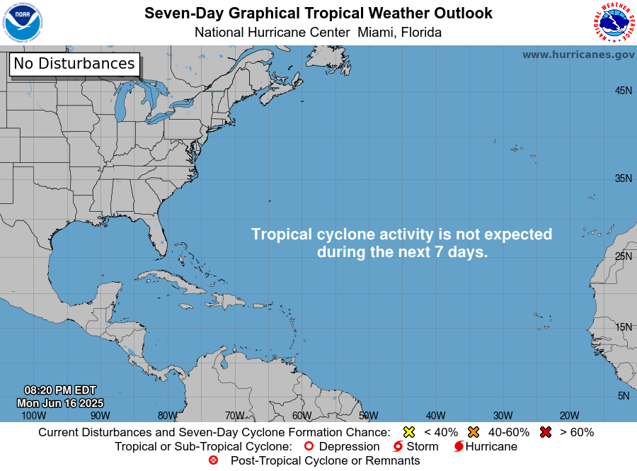
THE TROPICS
For the North Atlantic, Caribbean Sea, and the Gulf of Mexico: Tropical cyclone formation is not expected during the next 7 days.
Category: Alabama's Weather, ALL POSTS, Severe Weather, Social Media, Tropical, Weather Xtreme Videos
About the Author (Author Profile)
Scott Martin is an operational meteorologist, professional graphic artist, musician, husband, and father. Not only is Scott a member of the National Weather Association, but he is also the Central Alabama Chapter of the NWA president. Scott is also the co-founder of Racecast Weather, which provides forecasts for many racing series across the USA. He also supplies forecasts for the BassMaster Elite Series events including the BassMaster Classic.Subscribe
If you enjoyed this article, subscribe to receive more just like it.


