Severe Thunderstorm Warning: Marshall, Jackson, and DeKalb Counties Under Threat This Afternoon
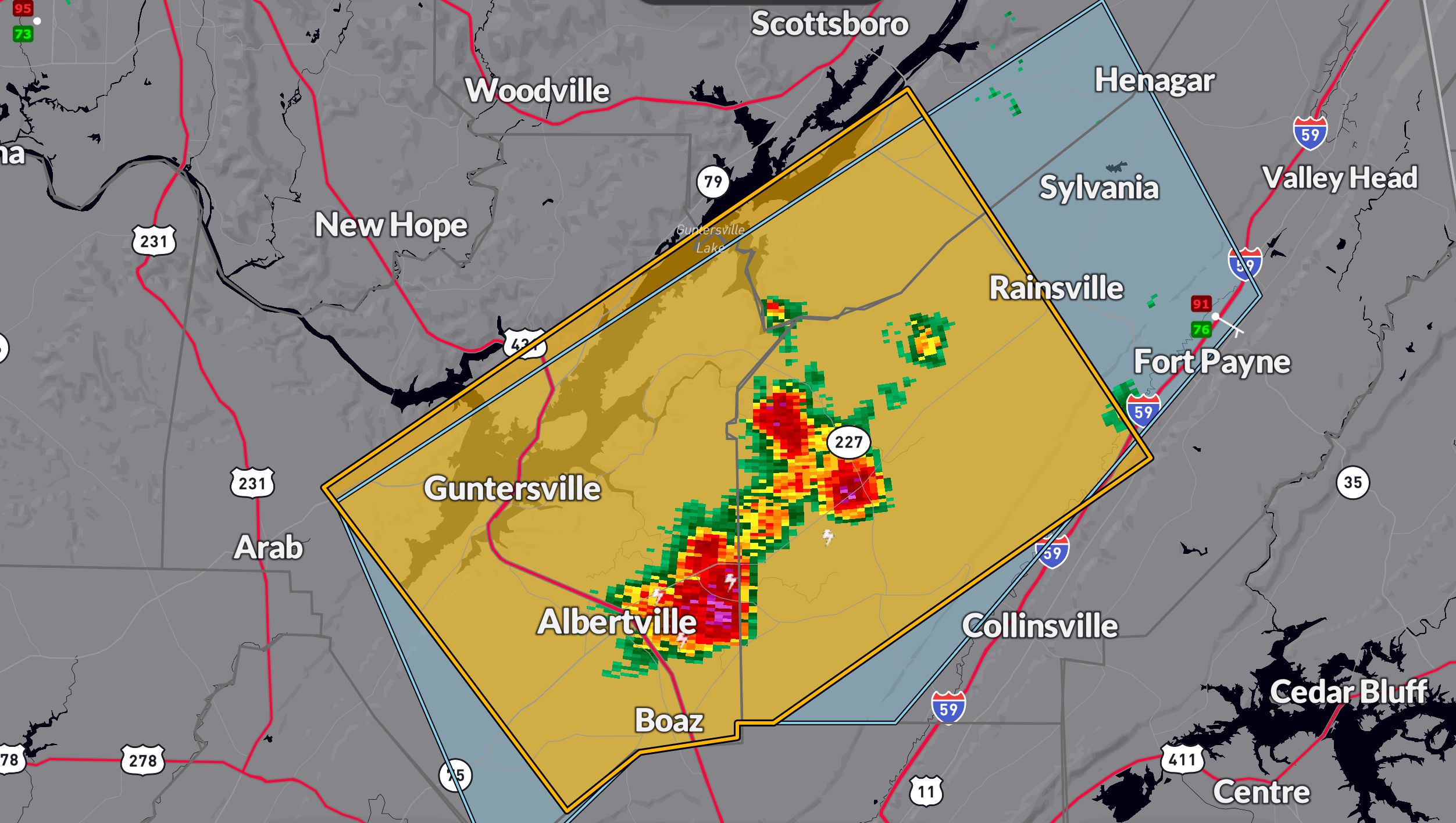
A nearly stationary cluster of severe thunderstorms is impacting parts of northeastern Alabama this afternoon, prompting a warning until 3:30 PM CDT for eastern Marshall, south central Jackson, and southwestern DeKalb counties.
At 2:27 PM CDT, radar indicated strong storms stretching from Albertville to Fyffe, producing wind gusts up to 60 mph and penny-sized hail. Areas at risk include Albertville, Boaz, Guntersville, Rainsville, Crossville, Fyffe, Powell, Geraldine, Section, and Langston.
These storms have developed in an unstable air mass characterized by high temperatures in the mid 90s and surface dewpoints in the 70s, supporting CAPE values in the 2500–3500 J/kg range. While upper-level winds are weak, the environment is ripe for strong downbursts and locally heavy rainfall, especially as storms train over the same areas.
Flash flooding is a growing concern due to torrential rain rates and slow storm motion. If you are in a flood-prone area or near low-lying terrain, remain alert and be prepared to move to higher ground if needed.
Take shelter in a sturdy building and stay away from windows until this storm passes.
Category: Alabama's Weather, ALL POSTS, Severe Weather, Social Media
About the Author (Author Profile)
Bill Murray is the President of The Weather Factory. He is the site's official weather historian and a weekend forecaster. He also anchors the site's severe weather coverage. Bill Murray is the proud holder of National Weather Association Digital Seal #0001 @wxhistorianSubscribe
If you enjoyed this article, subscribe to receive more just like it.


