Midday Nowcast: Sun, Heat, and Strong Storms
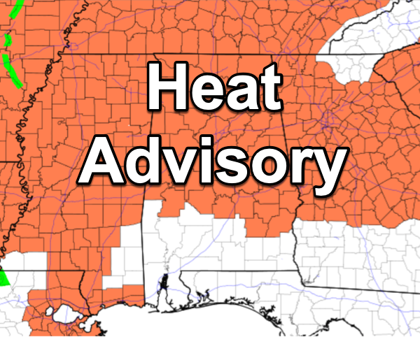
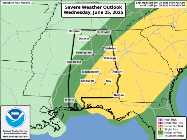
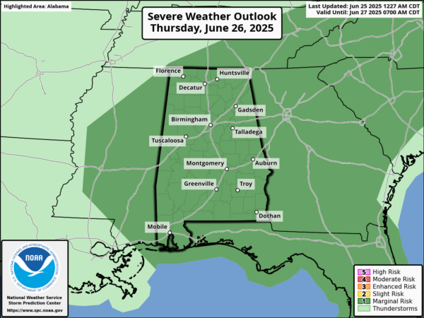
SUN, HEAT, STORMS: Hot temperatures and high humidity are causing those feels like temperatures to surge above 105° again today, and is why we continue to see Heat Advisories for the northern two-thirds of Alabama. Along with the heat, we have to deal with the threat of strong storms. As storms develop today, the will be fairly scattered, but where they occur they will be strong to severe due to the high instability values across the state. Again Big HEAT, Big STORMS and the Storm Prediction Center has much of Alabama in a severe weather risk both today and tomorrow.
Where afternoon and evening storms develop they will likely produce strong, gusty winds and hail. Of course, all summer storms produce frequent and dangerous lightning (WHEN THUNDER ROARS, HEAD INDOORS), along with intense, tropical downpours, which can lead to areas of isolated flash flooding (TURN AROUND, DONT’ DROWN).
BIRMINGHAM ALMANAC: For June 25th, the average high for Birmingham is 90° and the average low is 70°. The record high is 101° set in 2024, while the record low is 49° set in 1974. We average 0.17” of precipitation on this date and the record value is 1.99” set in 1932.
FRIDAY AND THE WEEKEND: The strong upper ridge will weaken and this opens for door for an increase in the number of afternoon/evening showers and thunderstorms, and lower heat levels. Highs drop into the 88-93 degree range with a mix of sun and clouds daily. Chance of any one location seeing rain each day rises to 40-50% percent range.
NEXT WEEK: Temperatures could be a little below average next week with highs in the upper 80s in many areas, otherwise pretty routine summer weather is the story with partly sunny days along with afternoon and evening showers and thunderstorms.
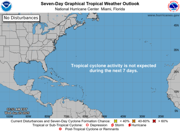
IN THE TROPICS: Andrea has dissipated and the rest of the Atlantic Basin is quiet.
WORLD TEMPERATURE EXTREMES: Over the last 24 hours, the highest observation outside the U.S. was 119.3F at Adam Airport, Oman. The lowest observation was -91.3F at Concordia, Antarctica.
CONTIGUOUS TEMPERATURE EXTREMES: Over the last 24 hours, the highest observation was 107F at Death Valley, CA. The lowest observation was 22F at Mackay, ID.
Category: Alabama's Weather, ALL POSTS, Social Media
About the Author (Author Profile)
Macon, Georgia Television Chief Meteorologist, Birmingham native, and long time Contributor on AlabamaWX. Stormchaser. I did not choose Weather, it chose Me. College Football Fanatic. @Ryan_StinnetSubscribe
If you enjoyed this article, subscribe to receive more just like it.


