Mix Of Sun And Storms Through The Weekend
RADAR CHECK: Most of Alabama is simply hot and dry this afternoon, but isolated showers and storms have formed. Heavier storms for the next few hours will be capable of producing lots of lightning and strong gusty winds; they will fade tonight after sunset.
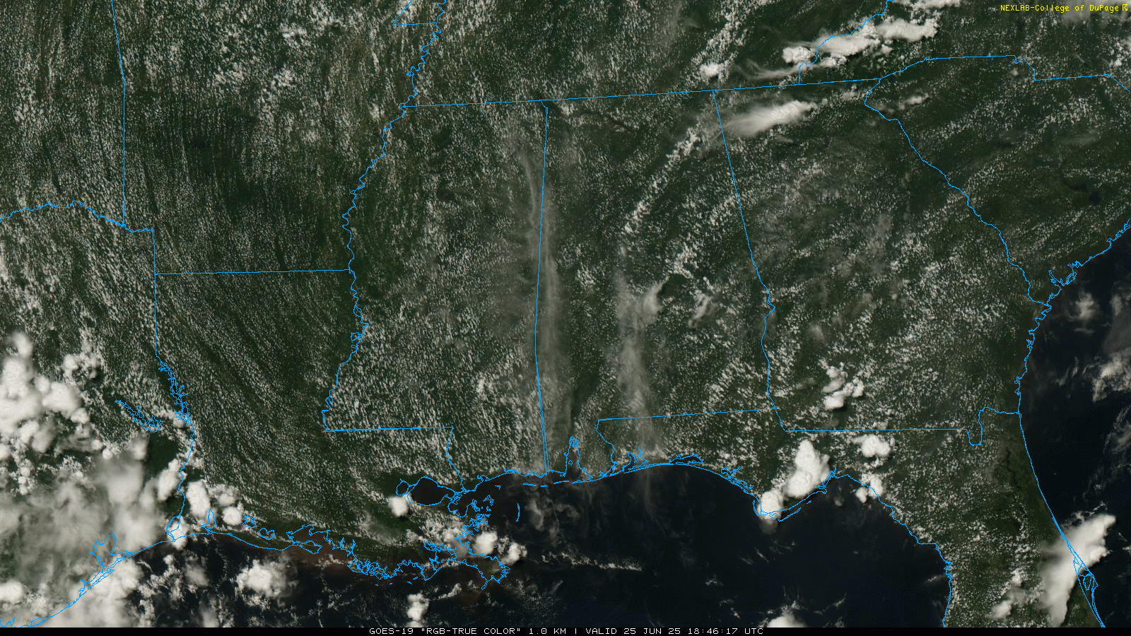
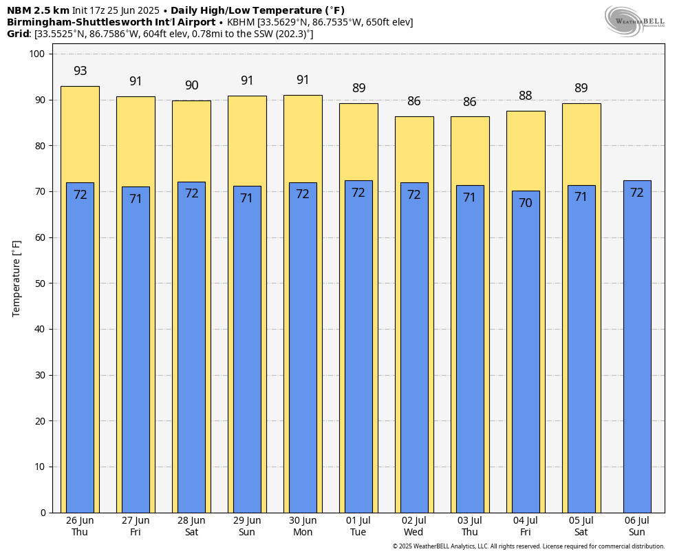
SUN AND STORMS: Tomorrow will feature a mix of sun and clouds with scattered showers and storms becoming more numerous. Some high resolution models even suggest a few morning showers could cross through the state. But, the stronger storms will come during the afternoon and evening hours. The chance of any one spot getting wet is 50-60 percent tomorrow, and the high will be in the low 90s for most places.
FRIDAY AND THE WEEKEND: The upper high over the eastern half of the U.S. will continue to weaken, which will mean slightly lower heat levels and a higher coverage of afternoon showers and thunderstorms. Highs will be in the 88-92 degree range, and odds of any one specific location seeing an afternoon storm will rise into the 55-65 percent range.
NEXT WEEK: Humid summer weather continues with a continued trend toward lower heat levels. Highs will be between 85 and 90 degrees on most days with the typical chance of a passing shower or thunderstorm daily during the afternoon and evening hours. See the video briefing for maps, graphics, and more details.
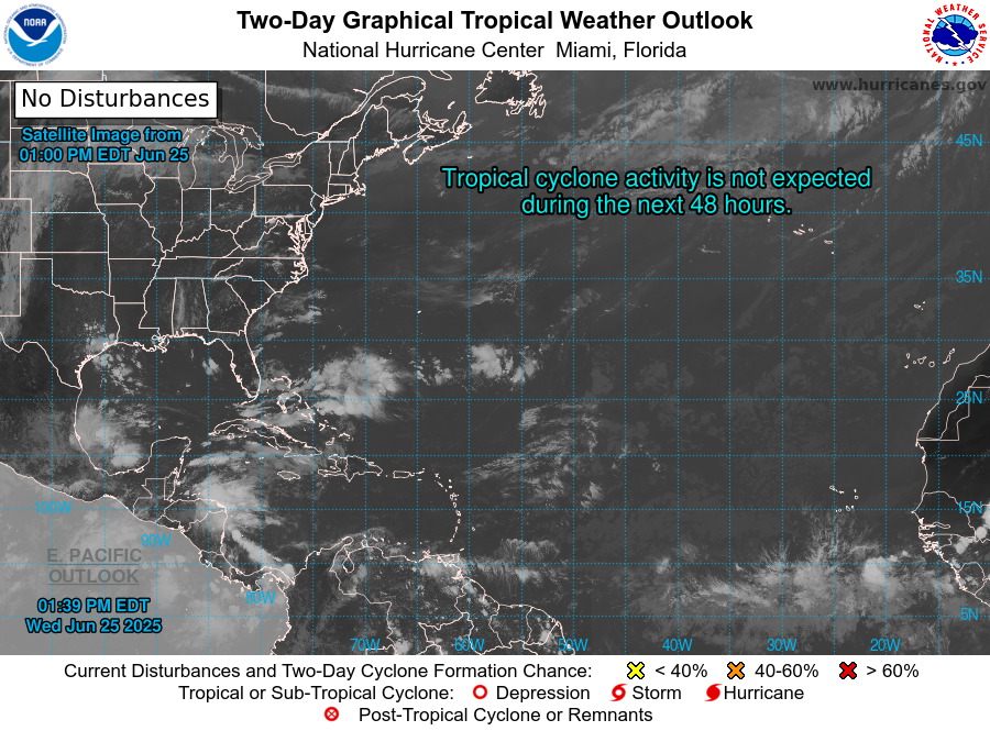
TROPICS: The Atlantic basin remains very quiet, and tropical storm formation is not expected for at least the next seven days.
ON THIS DATE IN 1957: Audrey reached hurricane strength; it was moving northward through the Gulf of Mexico; it would make landfall two days later near Sabine Pass and would be one of the deadliest hurricanes in U.S. history.
ON THIS DATE IN 1967: Three F3 tornadoes crossed the Netherlands on this day, killing seven people and producing widespread damage.
Look for the next video briefing here by 6:00 a.m. tomorrow…
Category: Alabama's Weather, ALL POSTS, Weather Xtreme Videos
About the Author (Author Profile)
James Spann is one of the most recognized and trusted television meteorologists in the industry. He holds the AMS CCM designation and television seals from the AMS and NWA. He is a past winner of the Broadcast Meteorologist of the Year from both professional organizations.Subscribe
If you enjoyed this article, subscribe to receive more just like it.


