Severe Storm with Hail and High Winds Moving Through Jackson and DeKalb Counties
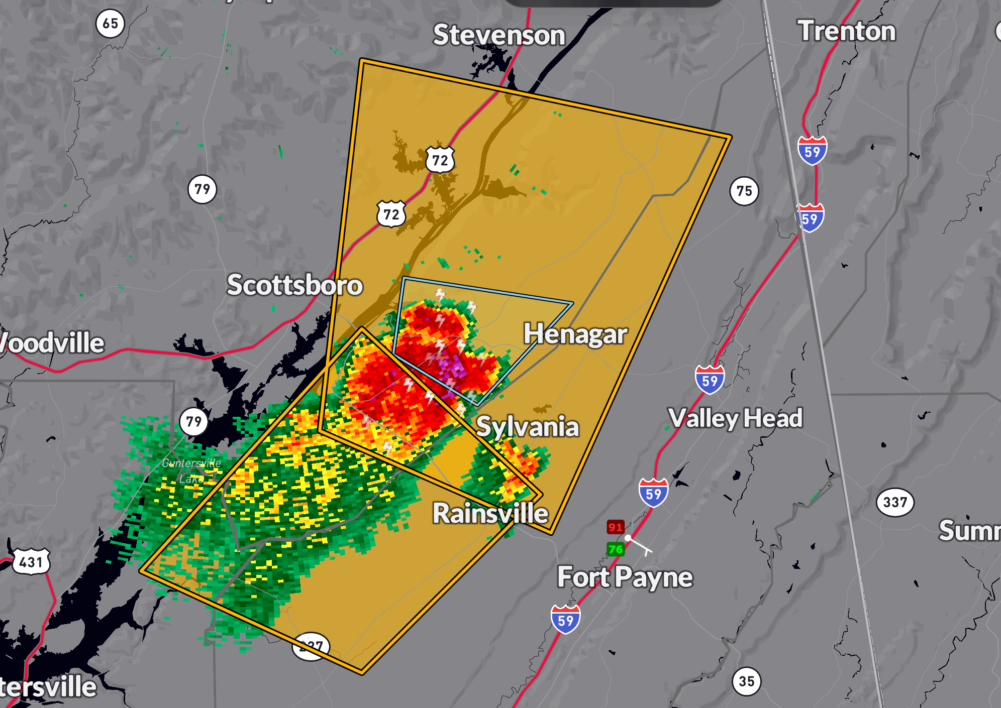
A severe thunderstorm warning is in effect until 4:30 PM CDT for central Jackson and DeKalb counties in northeastern Alabama. Radar at 3:53 PM showed a strong storm near Powell—8 miles north of Rainsville—drifting slowly north at 15 mph.
This storm is capable of producing wind gusts up to 60 mph and quarter-size hail, which could damage vehicles and cause tree and roof damage. Affected communities include Scottsboro, Rainsville, Henagar, Sylvania, Hollywood, Powell, Section, Ider, Pisgah, and Dutton.
Given the slow movement of this storm, locally heavy rainfall is likely, and some areas may see ponding or minor flooding, especially where earlier storms have already saturated the ground.
Take shelter now in a sturdy building, stay away from windows, and avoid travel until the storm has passed your location.
Category: Alabama's Weather, ALL POSTS, Severe Weather, Social Media
About the Author (Author Profile)
Bill Murray is the President of The Weather Factory. He is the site's official weather historian and a weekend forecaster. He also anchors the site's severe weather coverage. Bill Murray is the proud holder of National Weather Association Digital Seal #0001 @wxhistorianSubscribe
If you enjoyed this article, subscribe to receive more just like it.


